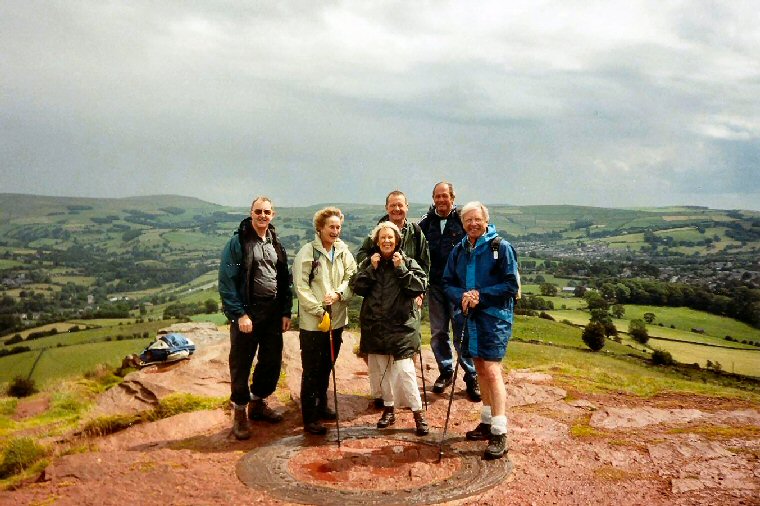
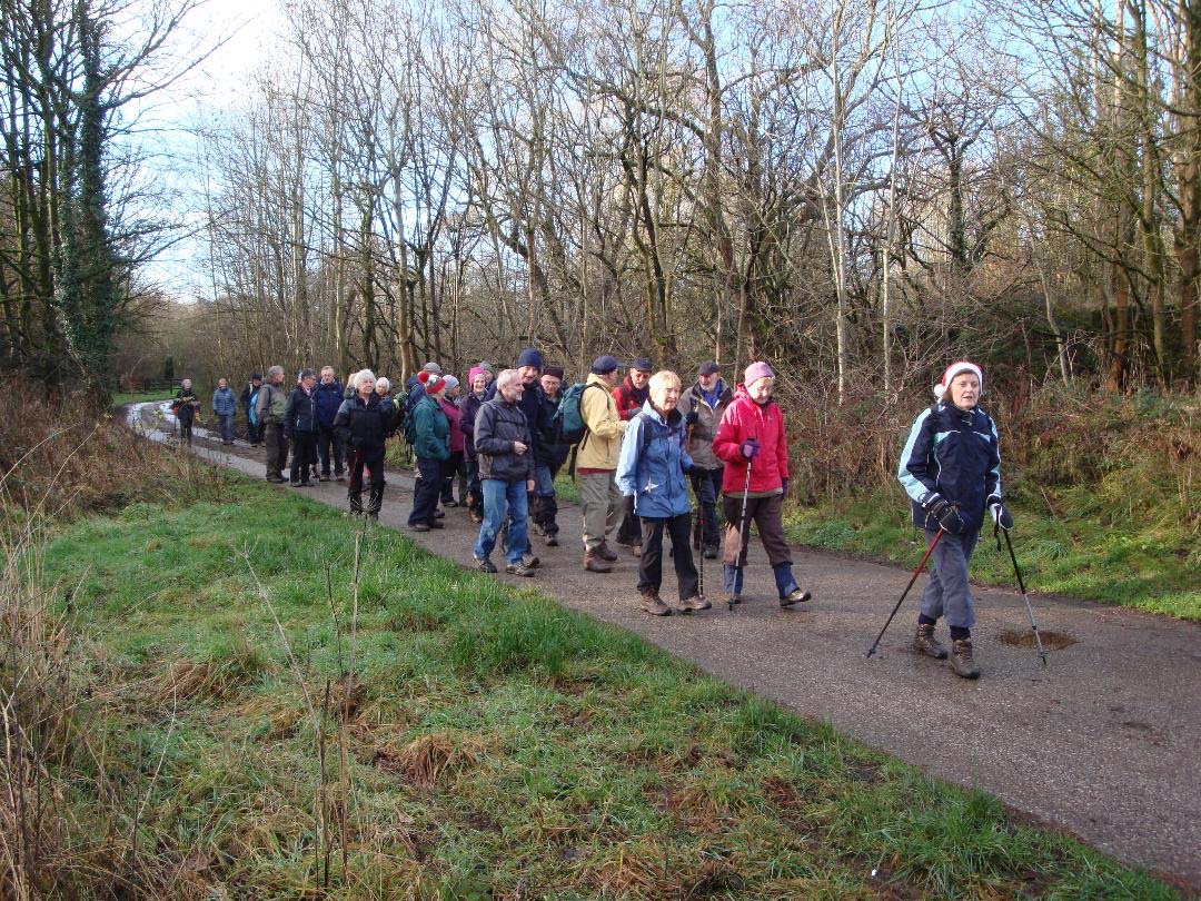
We usually meet on the last Wednesday of each month and on the second Tuesday of every other month, at 9:30am by the village hall. Walks are not long or strenuous; 5 or 6 miles on average, each with a different leader.  Come along to see the countryside in all its moods, sometimes bathed in sunshine, often with a shower or two, even perhaps with a carpet of snow!
Our walkers might pass stone-age remains, badger setts and tracks, and fascinating old farmhouses and cottages. They will certainly enjoy sweeping views over the Cheshire plain, Peak District panoramas of hills and dales, and gentler scenery by canals and parkland in Lyme, Alderley and Ladybrook.
You are guaranteed a friendly welcome when you join us.
Do come!
Group Leader David Burke
walking@highlaneu3a.org.uk
2018 Walk Programme
WALK REPORTS
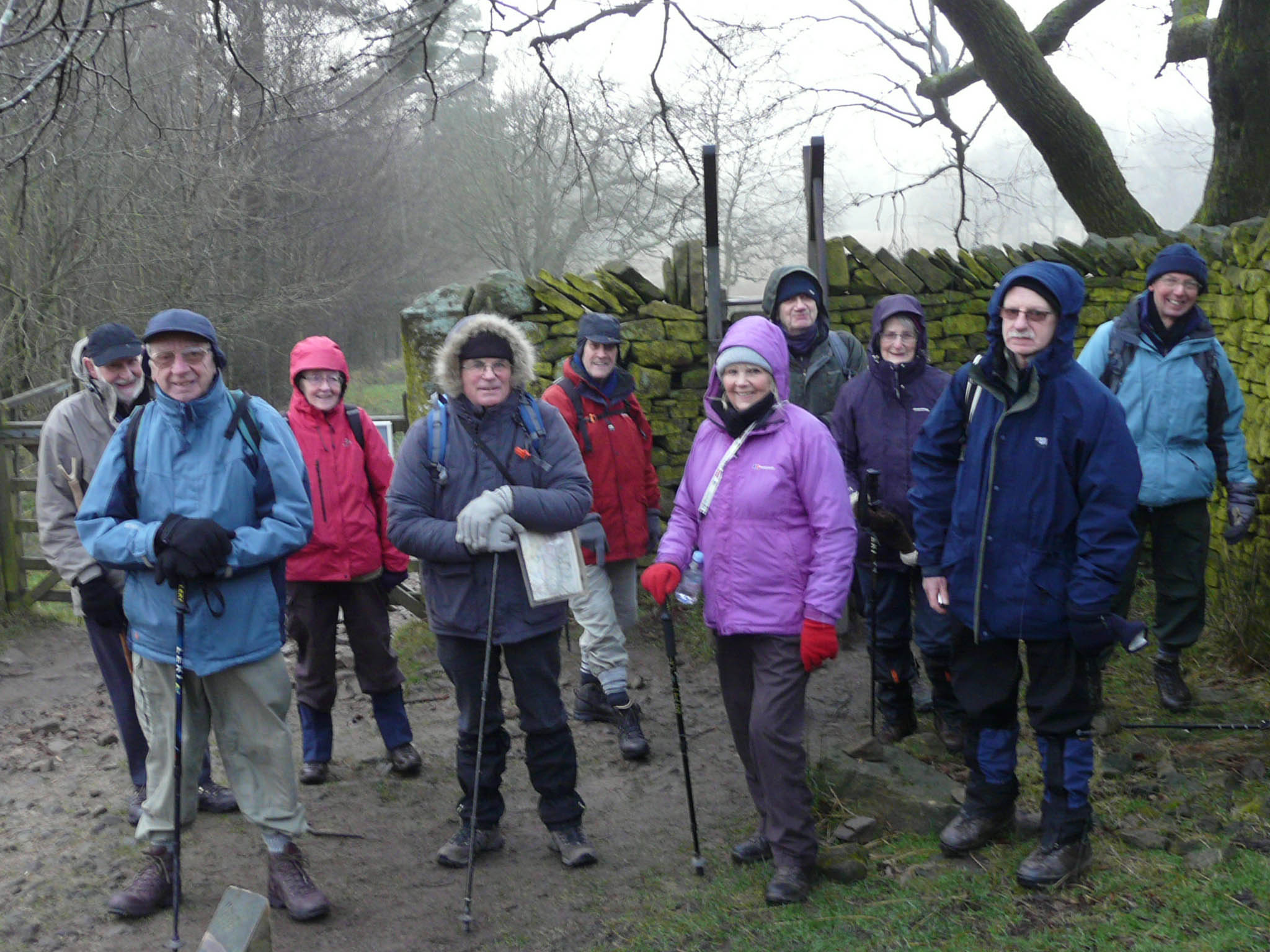
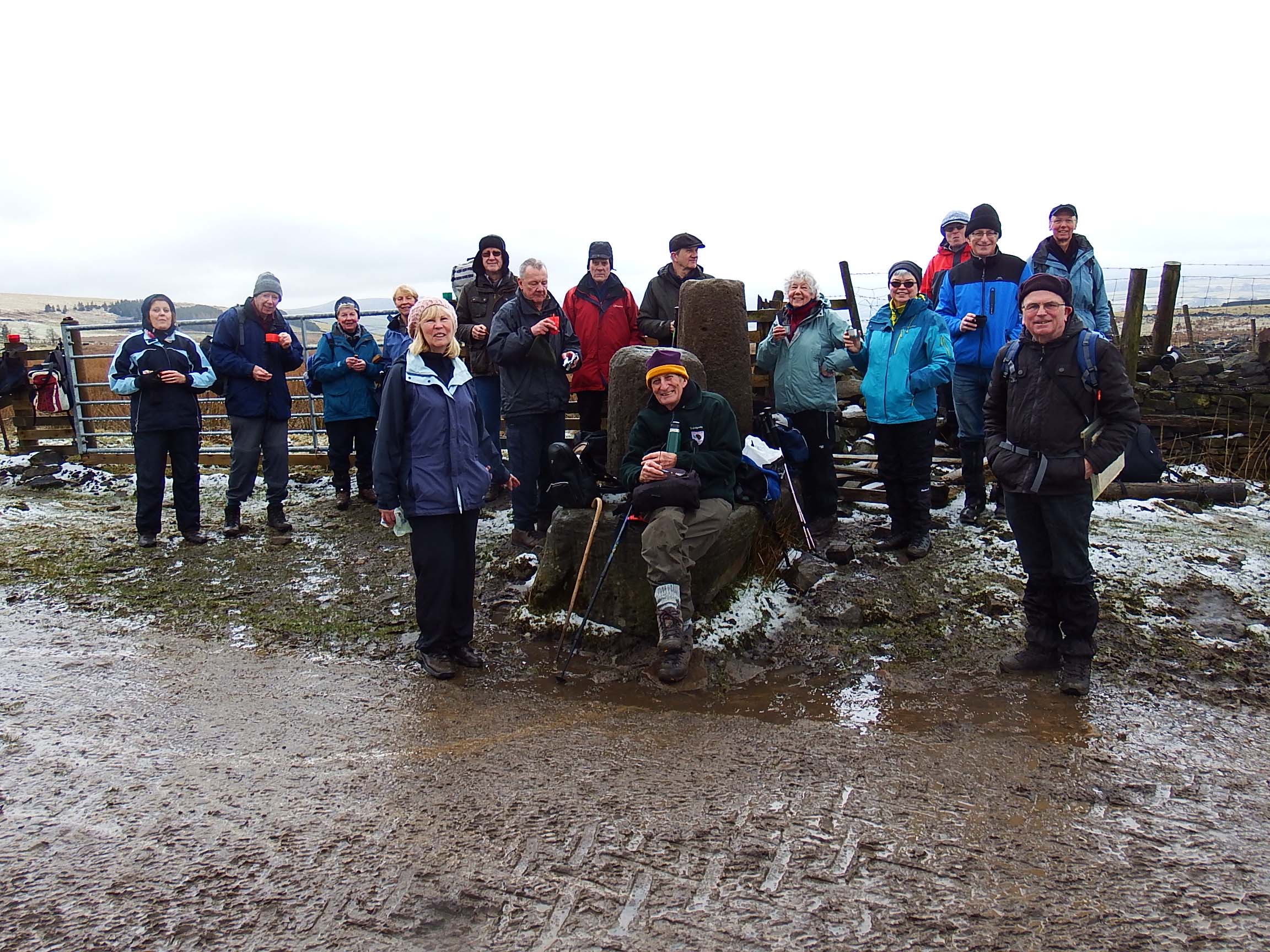
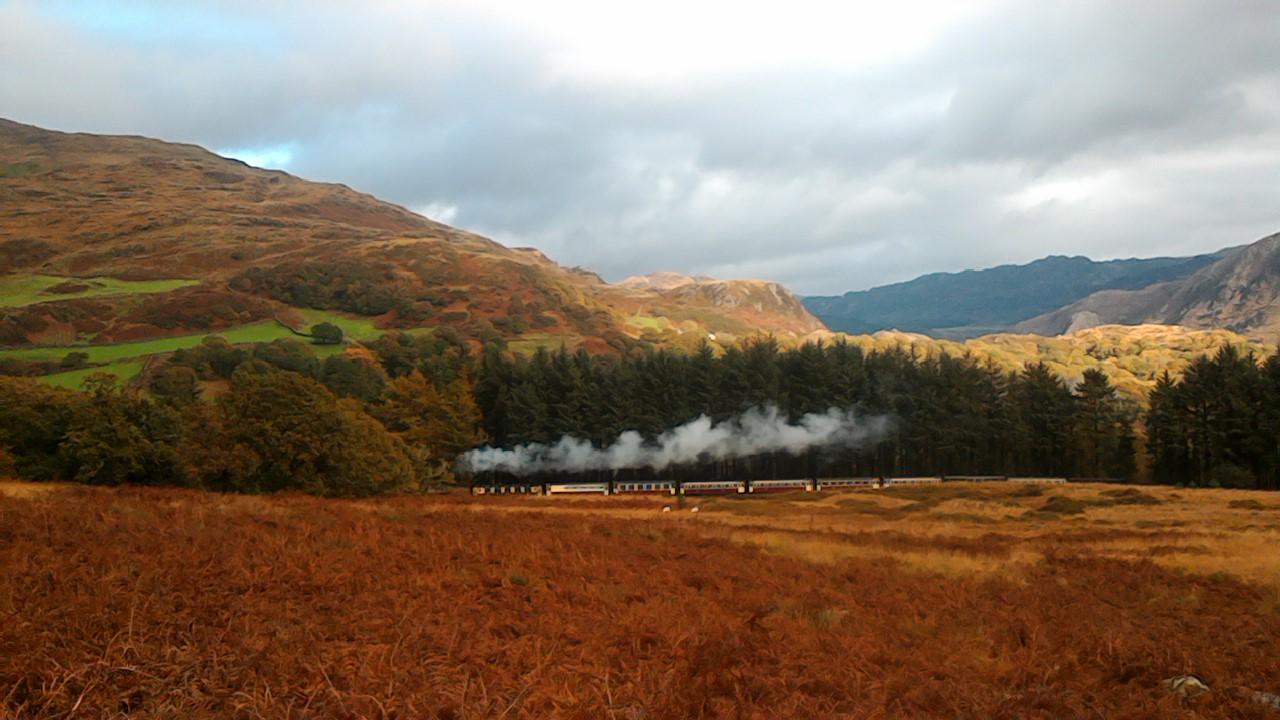
TUESDAY 9TH JANUARY 2018
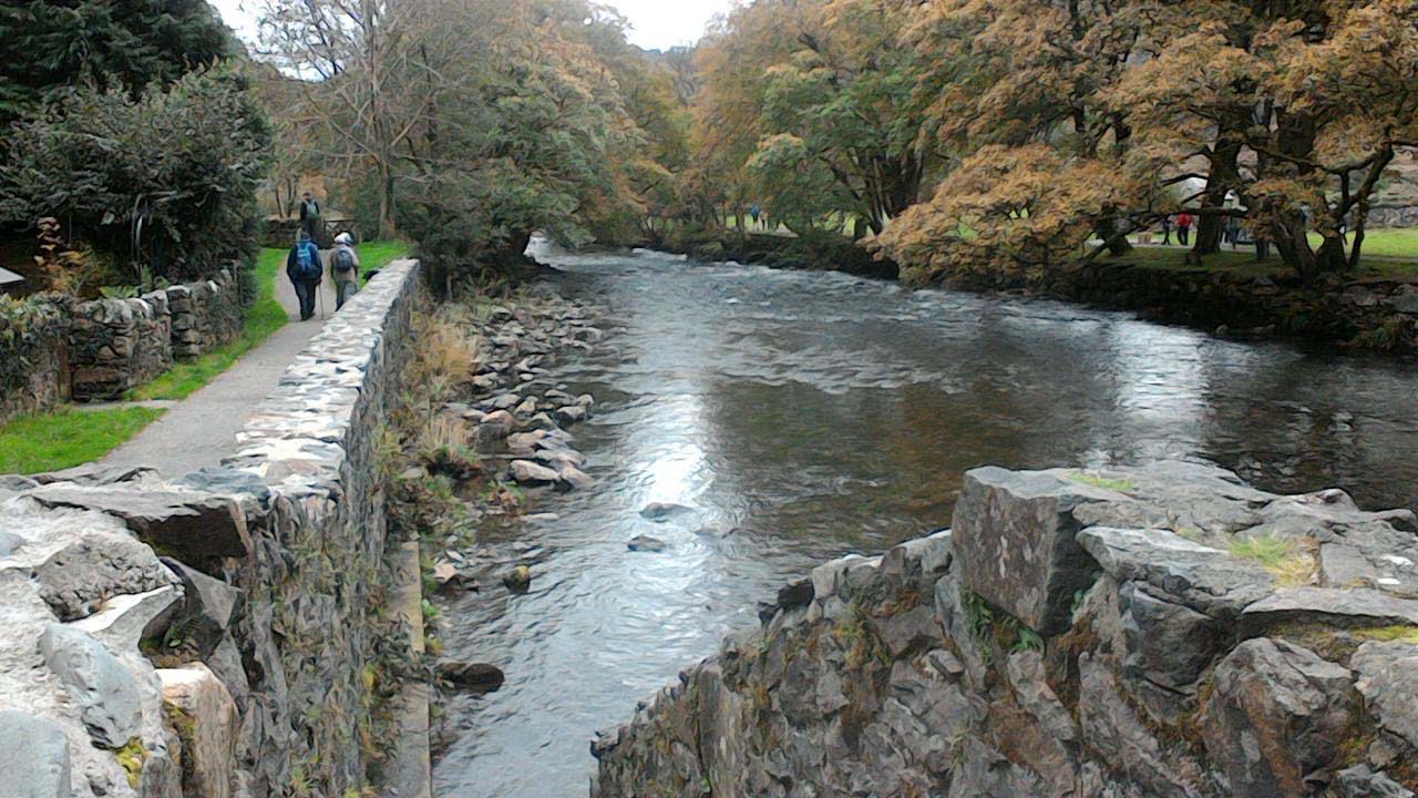
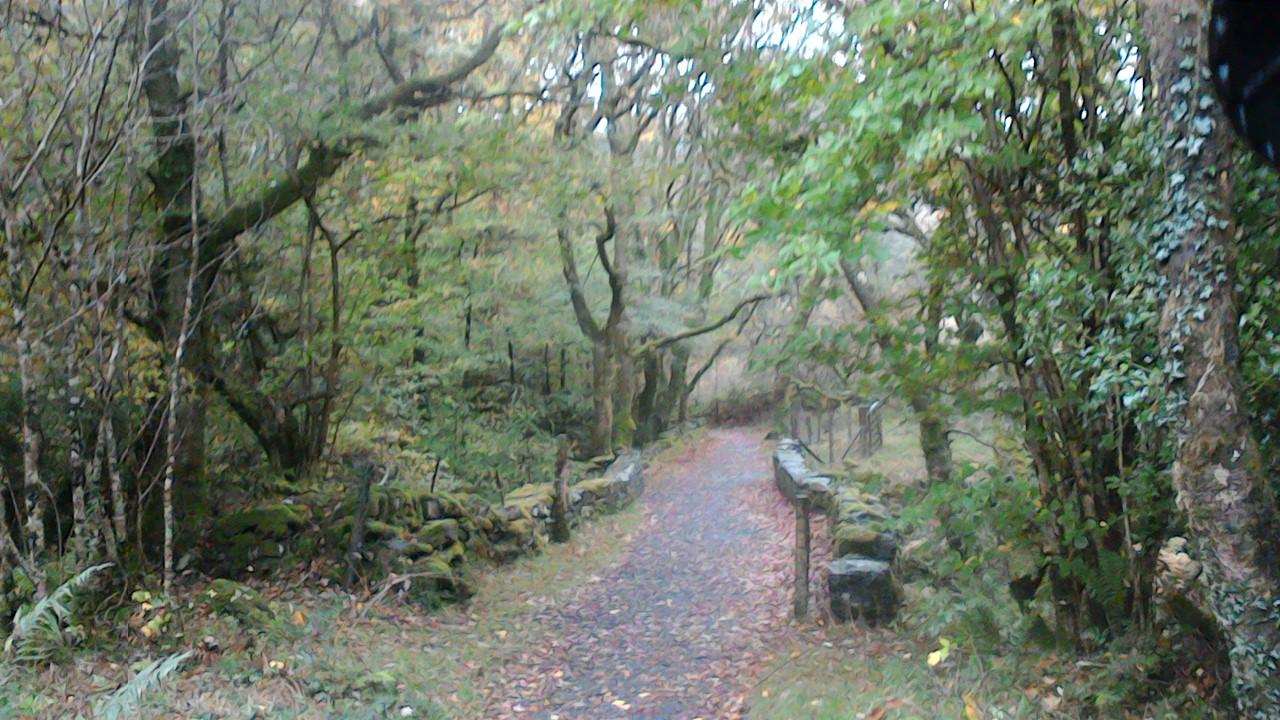
Walter led 11 walkers on a 4 mile walk from Lyme Hall car park. It was a grey day with a biting cold wind in exposed areas, but fortunately much of the route was sheltered by high walls and woods and we rarely felt the cold.
Starting towards East Lodge, we turned before Kennel Wood onto the wide track between Hampers Wood and Lantern Wood, then picking up the faint uphill trod by the wall and passing the disused quarry before turning right at the top and following the wall round to the summit of Higher Moor at 402 metres. Quietly situated there is a viewfinder donated by the local Monkhouse family, which made a handy coffee stop.
We continued through patches of ice flakes blown off trees and fences, and at Bowstonegate turned right to make a careful descent by the icy path towards Knights Low. To our delight, dozens of deer were feeding close by in the thick mist, almost undeterred by our passage. We turned left into the woods and followed round to the edge path above Cluse Hay, where mixed tree planting is transforming the upper Poynton Brook valley,. A loop took us back to restored Keepers Cottage and the gentle ridge by Pursefield Wood, to take steps down to the West car park and the easy amble back to the Hall.
It had been a different sort of day, with the all pervading mist shrouding views, but giving us an atmospheric detached and quiet walk, much on firm grass paths, with only occasional dog walkers around. Most then headed happily home, with just a few finishing off with a lunchtime carvery.
Walter Mason
Back to Walk Programme
WEDNESDAY 31st JANUARY 2018
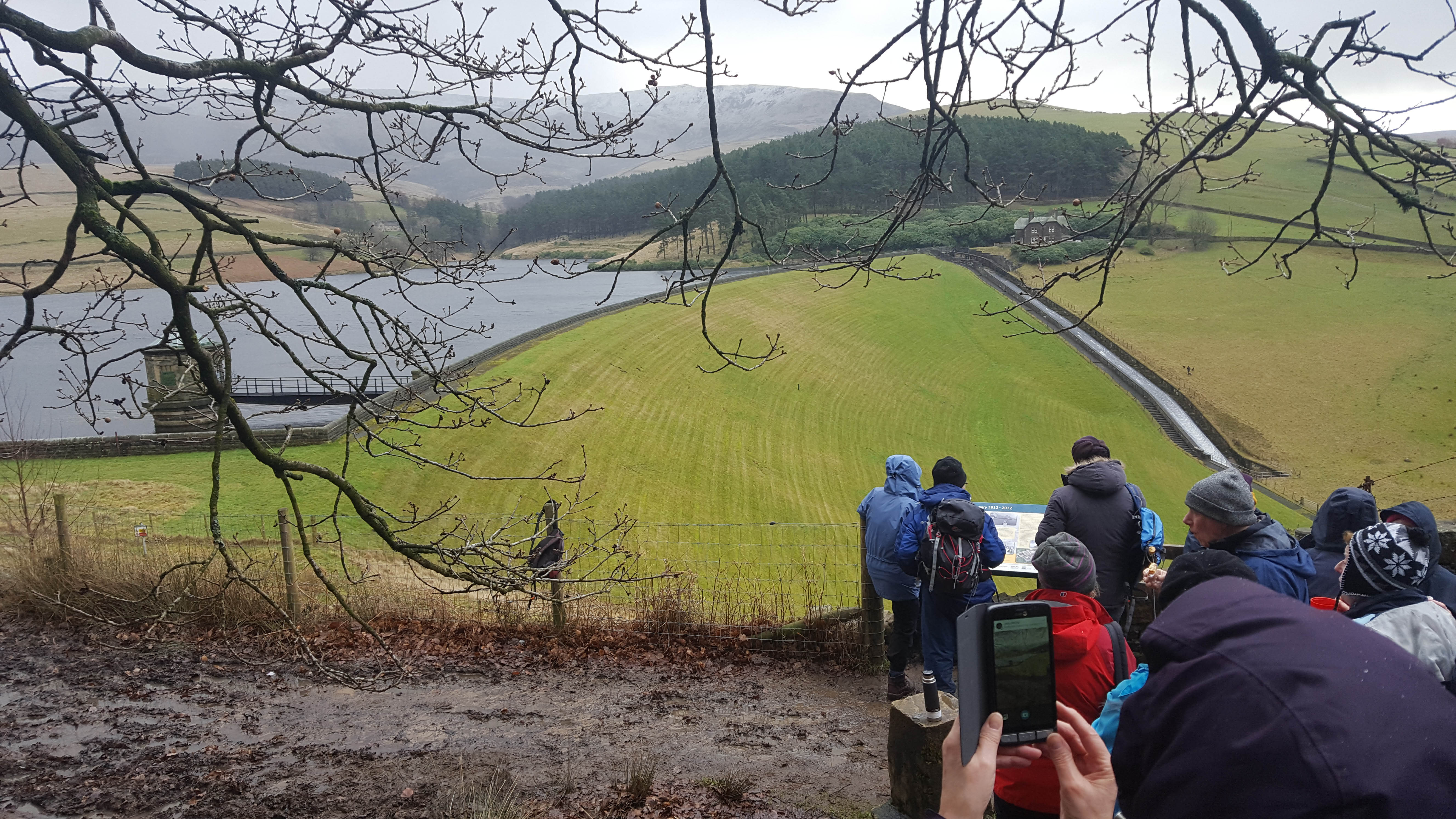
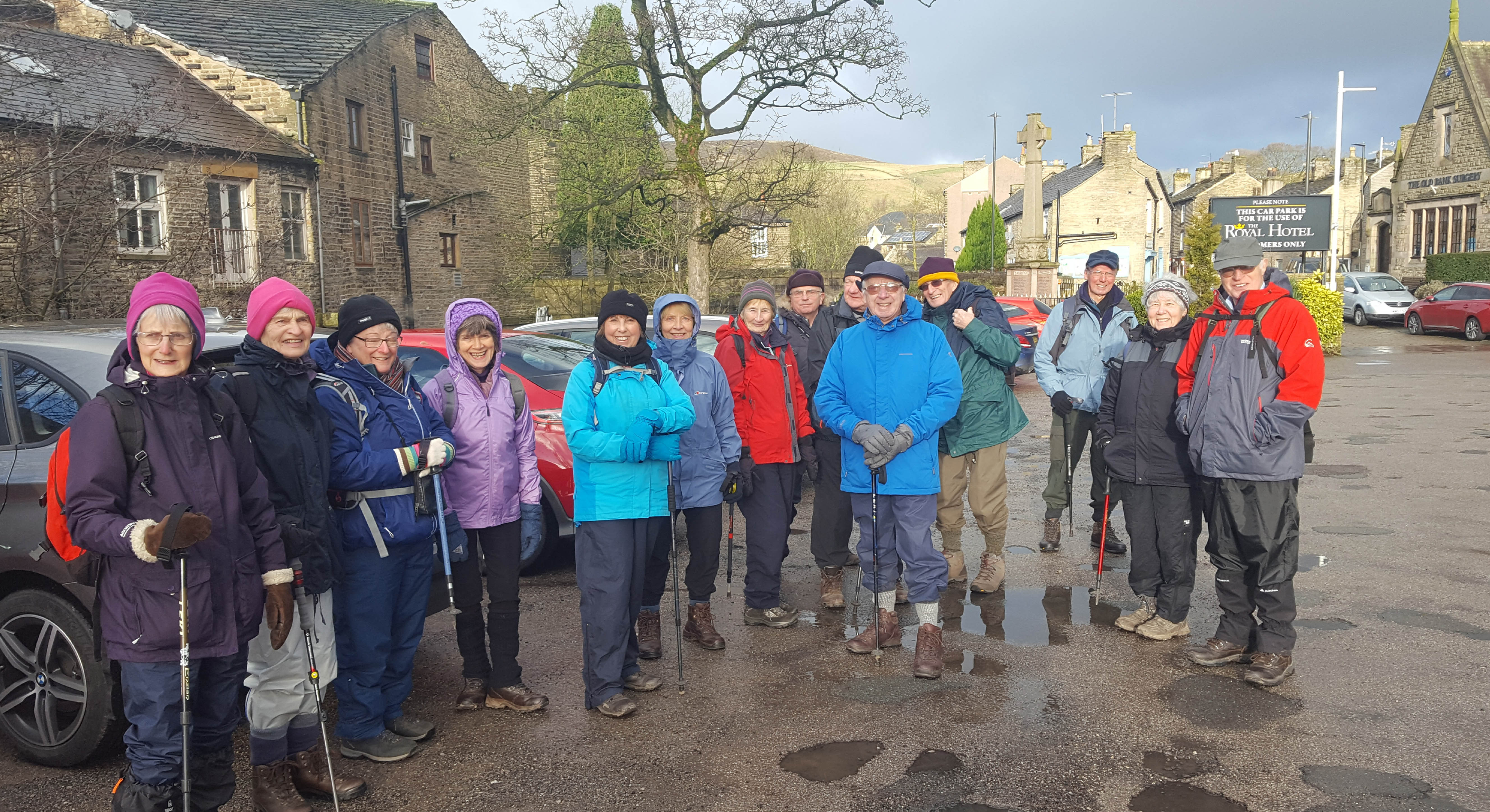
The walking group's 2nd January walk on the 31st Jan led by Sam and Irene Chappell began in Hayfield Village on a fine breezy morning that was to change as we made our way up onto Middlemoor. 18 walkers turned out for the walk that took us alongside the River Kinder on Kinder Road then on a path past Bowden Bridge and up to the information board overlooking Kinder Reservoir for our coffee stop. The views from here looking over the reservoir and up to a snow speckled Kinder Downfall were impressive.
The next stage of the walk involved a steep but short climb upon to Middlemoor with the views becoming even better as we gained height to join the Snake Path and our route back to Hayfield. Shortly the weather took a turn for the worst and visability became much reduced as we experienced a painful but exhilerating icy snow storm, blown along by a blustery northwesterly wind.
Safely back in Hayfield 9 walkers enjoyed the warmth and hospitality of the Royal Hotel where we were served some good food quickly and efficiently.
Sam and Irene Chappell
Back to Walk Programme
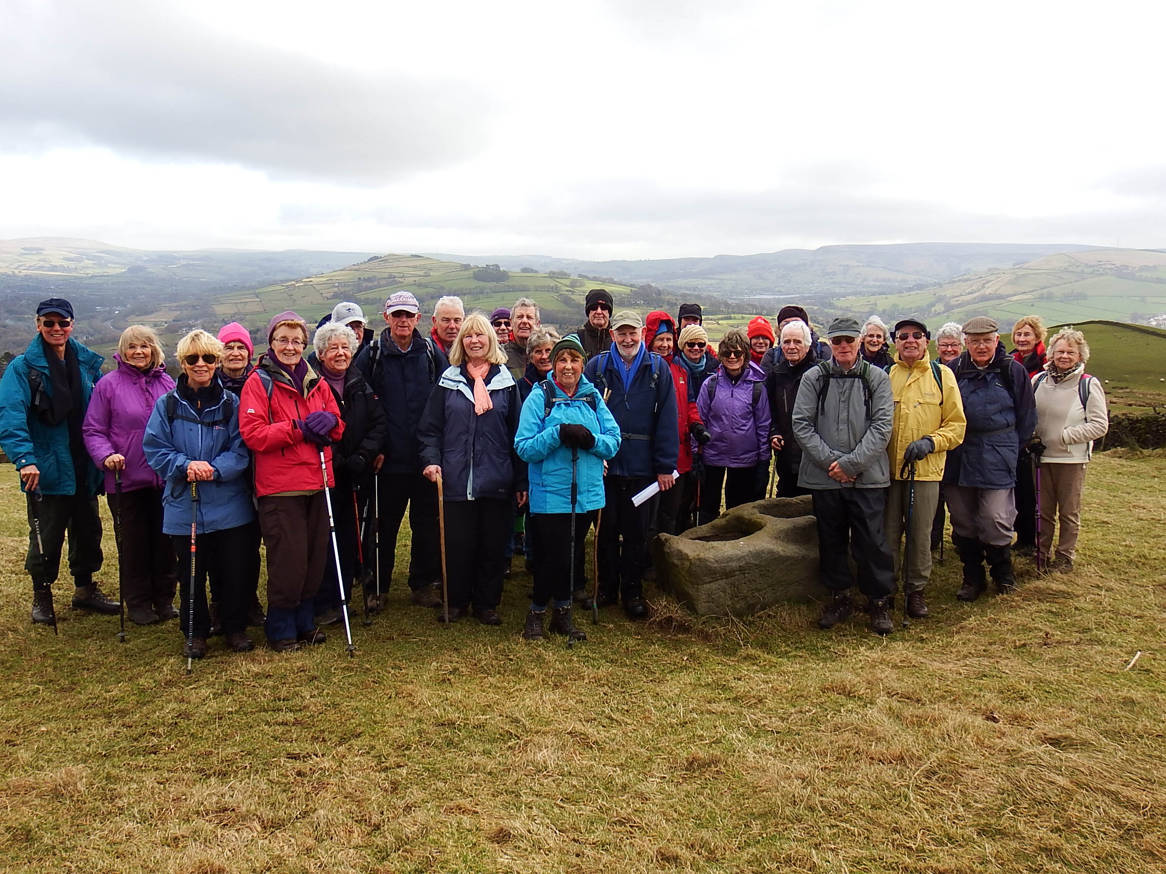
WEDNESDAY 21st FEBRUARY
Merlyn & Joyce led a 5 mile (Transport Trek) walk from Furness Vale to the Dipping stones.
Despite the cold winter weather of recent weeks we were blessed with a fine, sunny day for the 32 walkers that joined the February walk.
The Transport Trek walk started by the group catching the 199 bus from various stops as we journeyed to Furness Vale our walk start point. .Despite the road resurfacing work on the A6 no delays occurred and the group occupied a high percentage of seats on outward and return journeys.
The route followed Furness Clough passing small and large houses from our industrial past as we ascended to Diglee Farm and then Whaley Moor.
Merlyn gave a historical picture of Furnace the original name of Furness Vale from 1690 and the rich industrial past from iron smelting, Calico Printing, Coal Mines, and Fire Brick kilns. Rapid development occurring between 1796 to 1804 following construction of the Peak Forest canal, A6 turnpike Road and railway in 1831.
We stopped to admire the 3 Australian named Bungalows built by Knowles Barton (coal mine and brick furnace owner from 1905) on land where pit ponies used to graze. Nearby we stopped at a small white gate and an oil pipeline sign known locally as the village Secret." Joyce gave the history of the pipeline and its installation linking ports and airfields for supply under invasion conditions.
Following a group photo at the Dipping Stones we had a coffee stop and then admired the panoramic view of the Dark and White Peak hills. Our mountain conquered, the descent involved a tricky stile and boggy ground leading to Start Lane. Descent to Toddbrook Reservoir was through Slatersbank Wood with early signs of spring snowdrops and occasional sections of mud. We walked over the dam wall, through the park alongside the river Goyt to our surprised lunch stop.
Lunch was taken in the restored Victorian waiting room at Whaley Bridge station, thanks to Brian and Alison Allerton. Over lunch Brian gave a historical talk on the station and his passion and dedication in leading the team and obtaining funding for the building restoration was much appreciated by the group.
The last stretch of the transport trek was along the Peak Forest Canal to Furness Vale just in time to catch the 199 bus back.
David thanked Joyce and Merlyn on behalf of the group for a great walk.
Merlyn & Joyce Young
Back to Walk Programme
WEDNESDAY WALK 28 MARCH 2018
19 hardy walkers met at the 5 Lane Junction at the top of Mellor. Walk leader Steve Reynolds had warned that, although not long, the going was likely to be tough after days of poor weather. And so it proved.
We set off along the Shiloh Road with splendid views of Lantern Pike and then Kinder Scout. Unarmed, we joined the Gun Road and headed towards Pistol Farm before striking out across moorland to a farm track. We encountered serious mud on the diversion to Robin Hood's Picking Rods . Unsurprisingly these 2 stones have nothing to do with Robin Hood but are Anglo Saxon in origin and mark the boundaries of Mellor, Ludworth, Rowarth and Chisworth.
Retracing our steps through the same mud we crossed Ludworth Moor to Clough End, where we forded a stream before arriving at the tiny hamlet of Brook Bottom. There used to be a bleach works nearby but that is long gone.
A steady climb then followed as we headed towards Mellor Hall . Although the present building is 17th century there has been a hall on this site since medieval times. A short walk then to arrive at Mellor Church just in time to take sanctuary from a heavy shower and eat packed lunches.
From the Church, downhill to Lower Farm, before the sting in the tail. An upward slog past the Oddfellows Arms to Moorend and back to the starting point.
Walk length 5.5 miles
Steve Reynolds
Back to Walk Programme
Tuesday Walk 10th April 2018
Eleven of us drove in convoy to the Grin Low car park, just south of Buxton, with the intention of enjoying a 5 mile walk led by Jeff Mortimer. The planned route was via Solomon's Temple, Poole's Cavern, the old Cromford and High Peak Railway, and the (now empty) Stanley Moor reservoir.
On leaving our cars, it was obvious that low cloud would render visibility to be not more than a few yards for most of the walk. Climbing towards Grin Low Tower, otherwise known as Solomon's Temple, we traversed uneven ground caused by the remains of old lime kilns. On arriving at the Victorian folly, it was obvious that no views were possible as low cloud was upon us.
On leaving, we entered a wood but it was soon evident that this was the wrong wood as Jeff had become disorientated due to the mist. Soon we were in the correct wood, Buxton Country Park and we descended to the car park at Poole's Cavern where we stopped for a coffee break.
Passing a school with its playing fields, we crossed a muddy field to join a lane leading through Fern House (an equestrian centre), and then through some fields onto Grin Low Road.
Here, Jeff had planned to ascend to join to old railway trackbed through Harpur Hill Business Park, but due to the poor visibility, he decided to take a shorter route to pick up the line near Stanley Moor. He had not reccied this however, and unfortunately, the route took us through one of the muddiest farmyards ever!
Crossing a field, we stopped by a wall to eat our packed lunches. The visibility was still almost zero, which was a pity as the view would have been superb.
We continued, to pick up the trackbed and then we arrived at the empty Stanley Moor reservoir. Jeff explained that the reservoir had been built over a fault line, where lime stone and grit stone had met, so it had always leaked. The authorities had therefore apparently given up and drained it. Jeff thought that the smaller reservoir on the Leek road nearby must have taken over its duties.
After that we followed a track back to the car park. Despite the disappointing misty weather, the walk was enjoyed by all and it was suggested that we repeat the walk later in the year when the weather should be more favourable.

Jeff Mortimer
Back to Walk Programme
Wednesday walk 25th April 2018
Ford, Wash and Malcoff
David Burke led a group of fourteen on a 5.5 mile walk around the hamlet of Ford near Chapel-en-le-Frith. Ford is the oldest part of Chapel with records predating 1222.
We parked at Ford House in dry bright weather conditions and ascended Peat Lane, a lovely tree lined track with excellent views of the valley and the Chestnut Centre, alas now permanently closed. After passing through open farmland, busy with new lambs at play, we reached the bridleway at Tom Moor and followed it towards Hayfield. On reaching Roych Clough we had a welcome coffee stop by.
the peat stained stream, enjoying weak sunshine sheltered from the wind. Our route continued along the bridleway before following a downhill path to Shireoaks and then along a horizontal track in open countryside, however here the heavens opened and heavy rain and strong winds lashed us as the squall passed quickly through, but not before giving us a good soaking!
Under brightening conditions we followed the path to Breckhead and descended to Wash via a network of "hidden" paths. From Wash we followed a fantastic path along the river, under bright sunny skies, passing Cornheys Farm and stopping for our picnic lunch on reaching the bridge on the lane to Malcoff.
We then followed the lovely lane back to Ford. Unfortunately, as we approached Ford, the brisk wind delivered a violent rain, hail and thunder storm, giving us another soaking before we could take shelter in our cars! The weather did spoil it's manners but did not quench our enjoyment of the stunning area around the ancient hamlet of Ford.

David Burke
Back to Walk Programme
Tuesday Walk 8th May 2018
On a beautiful May spring morning 17 of us met at the Little Mill Inn in Rowarth. We began by walking uphill on a stony track which soon levelled out to give panoramic views of the surrounding hills before reaching a minor road. We followed this downhill before turning off left and then uphill again following the National Trust signpost to Lantern Pike. After our coffee break the more energetic walkers climbed to the summit of Lantern Pike (373m ) and met up with the rest of us a little further along the main path, extolling the magnificent views they had seen from the top.
Walking over grassy paths, we then followed the track over Matley Moor heading for the far end of Coombes Rocks. Having reached the highest point of our climb we enjoyed our lunch break in the glorious sunshine looking out over the fantastic countryside surrounding us.
We then completed our walk by walking along Cown Edge Rocks, enjoying a completely different view of towns and hills before dropping back down over grassy field paths into Rowarth. The day concluded with a welcome drink in the Little Mill Inn.
Shelagh Stokes.
Back to Walk Programme
Wednesday walk 23rd May2018
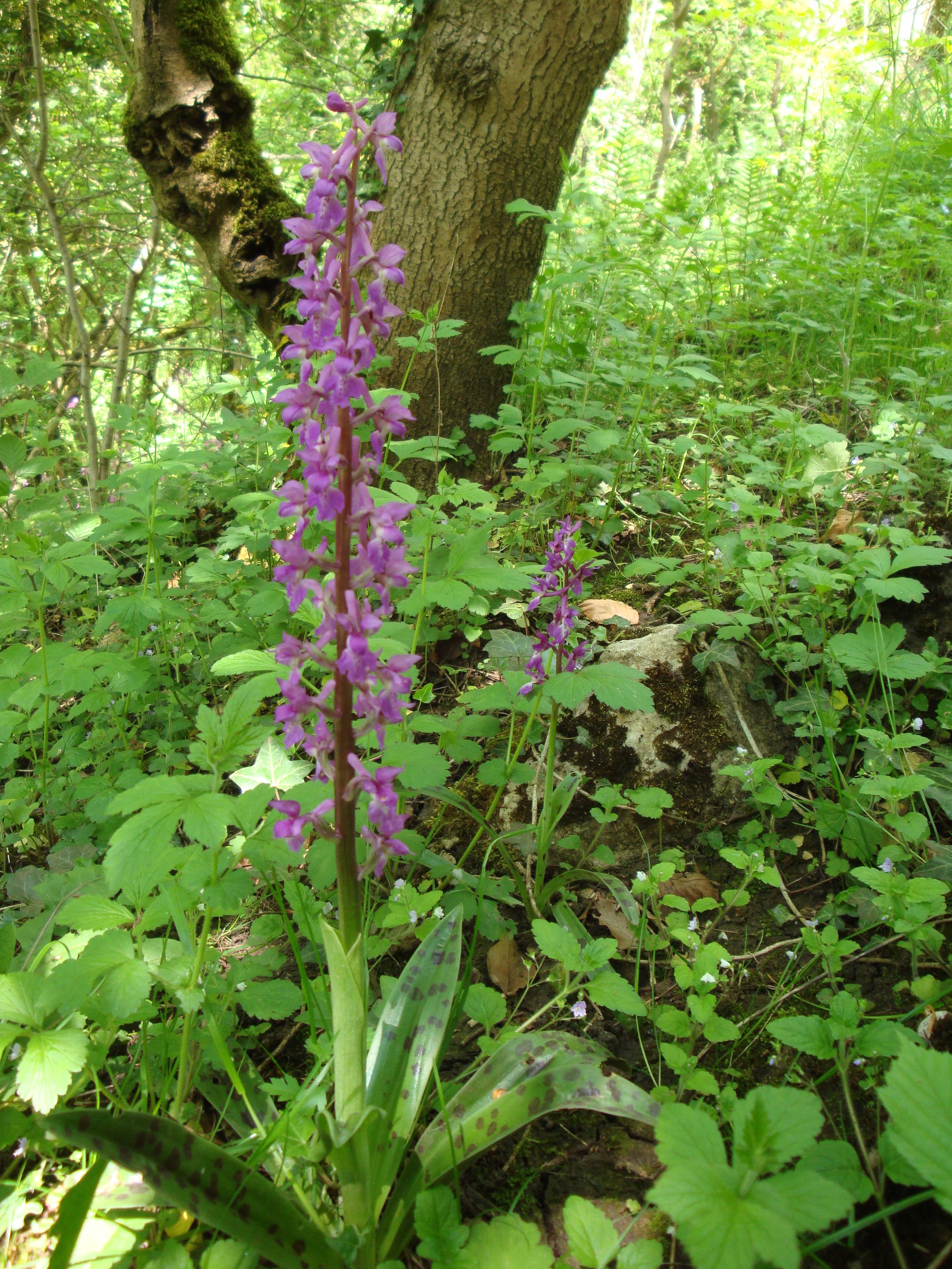
19 folk set off from Wormhill to accomplish a 'challenging walk'. Wild
Orchids were easily seen from the path as we walked down to Cheedale.
Everyone managed to get to the top of the steep hill from the valley for
a coffee stop with wonderful views. Passing through Blackwell Hall Farm
and into the hamlet of Blackwell was delightful in the warm sunshine.
Climbing up a lane near Priestcliffe we veered off onto a track finding
a good spot for our picnic lunch again with views. Then downwards on a
long mostly stony track (meeting two motorcyclists coming towards us!)
we eventually got to the B6049 road carefully walked down near to
Millers Dale turning left to walk back to Wormhill by the river Wye.
Ruth Smith
Back to Walk Programme
June 3rd to 5th (Llangollen Holiday)
The Llangollen Summer Break went like a dream. Ideal weather, attractive walks, friendly crowd, interesting entertainment, and no organisational problems of course, as organiser I would say that but happily, others seemed to think so too!
It was our second visit to the Hand Hotel. It is perfectly situated by the river near the centre of Llangollen, comfortable, historic, the staff are easy-going and helpful, and food is tasty in straightforward style. We had both dining room and entertaining room to ourselves. On the other hand, there is no lift to avoid the several stairs, and some of the food on the second day seemed different from our pre-chosen menu!
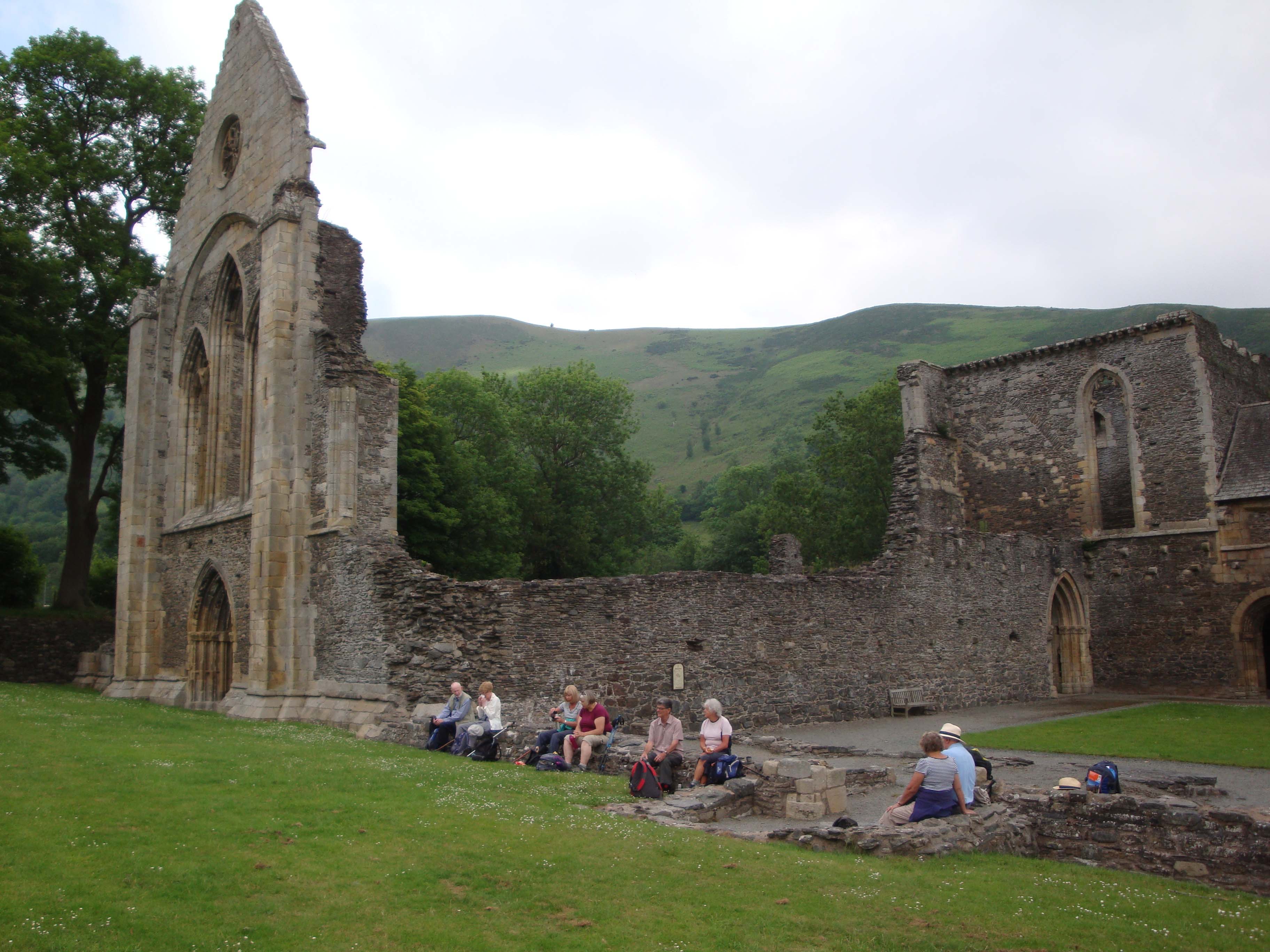
As on our first visit to Llangollen, Erdigg (NT) made a splendid rendezvous, especially as the varied wooded slopes by the River Clywedog offered comfortable sheltered walking on a hot sunny day. This time the 5 mile walk traversed Big Wood, then continued on a permitted path through meadows past Bryn-y-cabanau, up and down on a woodland path and then down to the river bank for lunch. Locals from Hightown (a suburb of Wrexham) warned against trying paths in the swampy far woods (where the official Clywedog Trail is purported to go!), so we followed the knowledgeable dog walkers to the Sontley Bridge road, there to rejoin the pleasant paths in Coed-y-glyn Wood. Most continued on a loop to Felin Puleston, while others shortcutted to refresh happily with generous mugs of tea in the NT outdoor tea garden.
The following day, on the main 8 mile walk, our full group of 22 started with a short steam train ride to Berwyn Station. After the train buffs had seen enough, the group crossed the River Dee by the historic Chain Bridge, went over the canal, and up steps to Llantysilio Green car park. There the group split. A 5 mile lower level walk avoiding steep climbs tempted a few, but the majority opted for the Eglwyseg Valley circuit. This featured Valle Crucis Abbey, one of the finest medieval sites in North Wales, beautiful river valleys, church and country inn both dating from the 15th C, and excellent views. The route first crossed the lower slopes of Coed Hrydden, and after visiting the abbey (which made an ideal coffee stop) and making a wide loop, it followed a delightful track through the wooded slopes of Fron Fawr and along the edge of the Eglwyseg Valley. After passing the Britannia Inn (happily open to wet down the packed lunches!), the route returned first on the occasionally tricky low slopes of Maesyrychen mountain, then (as the easier 5 mile route had done) following a section of the Dee Valley Way, passing Llantisilio Church, the Horseshoe Falls, and the beautiful Llangollen Canal back to the Hand Hotel. It was not all perfect! One or two awkward stiles on the easy route, and the tough climbs on the main route, tested some of our walkers, especially on a warm day. Some even questioned the veracity of the quoted distance! But a drink or two later, at the Chain Bridge or Hand Hotels, and all was well (I think?)!.
The last day saw various activities, - town shopping, - visiting Chirk Castle and Bodnant Gardens (both NT), - but a good crowd went on the prepared circuit circunavigating Dinas Bran with close up views of Trevor Rocks, and later a lovely contouring path from Wern-uchaf to Geufron. One couple (Ed and Carole) made a quick dash for the summit castle ruins, but most enjoyed the less demanding paths and minor roads.
Evening entertainment had two contrasting themes. The first evening had lots of audience participation, with teams competing at stand up Bingo, presenting their chosen or allotted jokes, and trying to find popular answers at Family Fortunes. Plenty of laughter and an equal number of groans so a good relaxing evening. The second evening was more cerebral, apt after a hard days walking; again with teams, but this times with quizzes one on car models, another on places around High Lane, with gentle background dance music appropriate for a banqueting suite! The quizzes seemed to find favour challenging but not impossible.
My thanks to David and Freda for reconnoitring the walk routes with me, and particularly to the group for the gift - well chosen!
Soon it will be time to think of next year. Where might High Lane u3a go next? Dovedale? Grange-over-Sands? Coniston? Grasmere? Bourton-on-the-Water? Forest of Bowland? The Wirral Peninsula? Anglesey? Still plenty of scope, and time, for someone else to take over the mantle, and deliver yet another enjoyable weekend for the walking group in 2019!
Walter Mason 21st June 2018
Back to Walk Programme
Tuesday Walk 12th. June Mount Famine & Southhead
Due to various commitments and holidays our number was down to 8. The walk started from Kinder Road Hayfield and after crossing the river we followed it for a short way down the valley towards Hayfield. We then turned left to start the uphill climb and after negotiating a short overgrown path we emerged at the junction of Highgate road with a seat where we took a short stop to get our breath back and enjoy the view back over Hayfield.
Suitably refreshed we carried on up the tarmac road climbing steadily until the start of the Pennine Bridleway, this was then a steady but undulating gentle climb along which we stopped to admire views to our right down onto Peep-o-Day and across to Chinley Churn and Cracken Edge.
A well earned coffee break was taken just before we approached Mount Famine and Southhead.
Four of the more adventurous in our group decided to take the steep narrow path up to the summit of Southhead whilst the remainder of us continued along the bridleway to the other side where we took an early lunch and waited for them to rejoin the party. Walter was first to arrive back closely followed by the 3 others at a more leisurely pace.
A long lunch break was taken, enjoying the good sunshine and the wonderful views past Mount Famine down Coldwell Clough to Kinder Scout and the hills beyond. After lunch we continued our journey downwards in single file along a quite steep narrow grassy track and through a patch of bracken before crossing a footbridge over a stream at the bottom and joining a bridlepath where we paused to look back up the steep slope to the summit of Southhead.
The bridle path took us past Southhead farm to meet up with a tarmac road which led us down to Coldwell Clough where we passed through the shelter of the trees which was welcome shade after being out in the hot sun. A short uphill stretch brought us to the start of a woodland path which continued downhill past the camp site to meet the river in the valley which we crossed by the footbridge to return to the starting point of our walk.
A 5 mile walk enjoyed at a leisurely pace with glorious sunshine and lovely views, and NO STILES!!!!

Jeff Robinson
Back to Walk Programme
Wednesday walk 27th June
Ten of us turned up for a re-run of the walk that Jeff took us on in April when the visibility was almost zero and the rain persisted throughout most of the day.
On this occasion, however, there was wall to wall sunshine and excellent visibility.
Setting off from Grin Low car park, to the south of Buxton, we ascended towards Grin Low Tower, otherwise known as Solomon's Temple, passing the remains of some lime kilns from times past. Arriving at the folly, we all ascended the tower, this time to admire the view and point out as many landmarks as we could identify. Jeff Robinson took photos of us on the tower and photos of us from the tower.
We then took a stroll through Buxton Country Park, down to Poole's Cavern where we took advantage of the covered pick-nick area to have a break for coffee.
Passing by Buxton School playing fields, we followed a track through Fern House Equestrian Centre, and then descended to Grin Low Road. After a short walk along this road, we ascended a path until we reached the old track bed of the Cromford and High Peak Railway. Here we rested and ate our packed lunch whilst admiring the excellent views.
We then followed the old track bed, passing through the rather unsightly Harpur Hill Industrial estate, and then the Health and Safety Executive research Laboratories.
After that we took a path parallel to the track bed, passing the now drained Stanley Moor Reservoir until we found ourselves back again at the car park. Here it was decided that our journey home should include a stop at The Shady Oak pub on Long Hill Road. This took place and we all partook of some welcome refreshment.
Jeff Mortimer
Back to Walk Programme
WALK REPORT WEDNESDAY 25TH JULY 2018
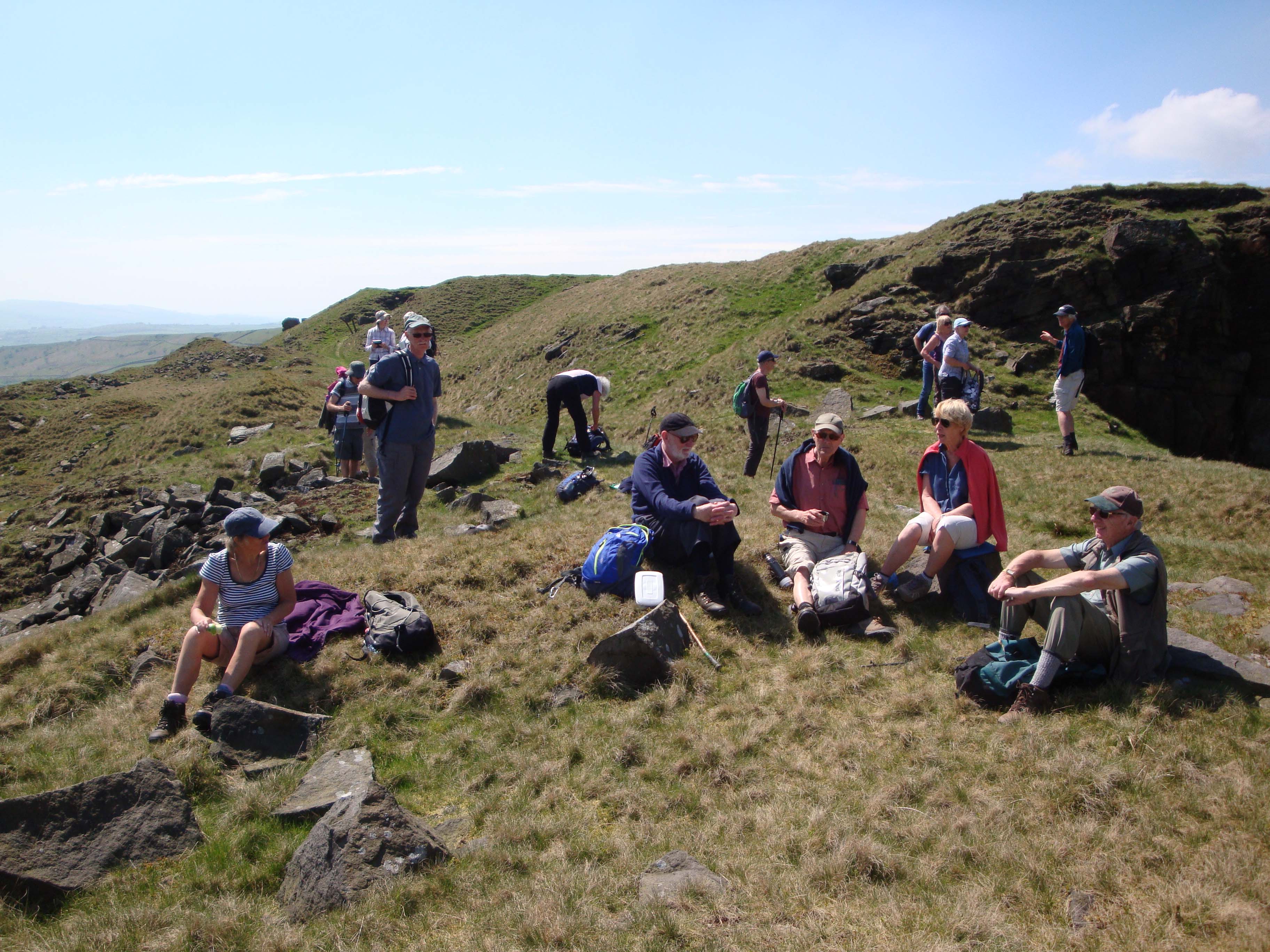
Only 9 came on Walter's walk to Combe Moss. Grandchildren minding, holidays, injuries, (surely none put off by the walk description?), took their toll on numbers. Whatever the reasons, they missed a cracking walk on a perfect day. Arriving late from Belgium the previous night, Walter's daughter and 13 year old grandson nevertheless joined the group, with personal interest in the walk starting from Chapel-en-le-Frith Station, where Walter's grandfather was station master and lived with his family in the Station House for 20 years.
The 6 mile walk started gently on a wooded lane past the Bank Hall Lodge and Farm, before rising steeply to Castle Naze and its ancient Fort, there to have a coffee stop. The next 3 miles we followed the narrow path along the winding western edge of Combs Moss, with varying wide-ranging views to our right, and the heathery, sometimes boggy grouse moor over the wall to our left. Occasionally we had to tread carefully, mindful of the hillside falling away, and later when two stream valleys made the path tricky (see photo); but mostly after the dry weather the path was quite comfortable. We disturbed 14 grouse, and an errant sheep and lamb the main flock was way below, being herded by the farmer!
Two shooting cabins were a natural place to lunch, augmented by some collected wimberries/bilberries, before we ascended slightly to the high point overlooking Long Hill, where a steep descent needed caution (see photo). Then we went down a natural line of footpaths past Combshead and Allstone Lea Farms, until at Rye Flatt the lane took us to Combs. The sunshine had been mellowed by a light breeze for much of the way, but later it had become hotter, and the Beehive at Combs was very welcome for refreshing drinks. Then it was on to the Hanging Gate and return buses, after a super walk with no other walkers in sight the whole day.
Walter Mason
Back to Walk Programme
Walk Tuesday 7th August 2018 Whaley Bridge, Kettleshulme and Goyt Valley Area.
David Burke stood in for Alison and Brian Allerton and led a group of eight on a 7 mile walk. The walk started from the lay-by on the A5005 near Horwich End. We crossed the river Goyt and followed the path passing Taxal Church, where two donkeys were making a very good job of cutting the grass in the churchyard!
It was then a steady, hot, pictureque climb westwards. Coffee was taken at the top of the climb before we proceeded towards Windgather Rocks and then on to Dunge Valley Gardens, which are now closed, we used the public footpath along the valley and made a strenuous climb up to Pym's Chair, where we all had a welcome rest and lunch was taken (see photo). From here it was down hill all the way into the Goyt valley towards Errwood Reservoir, before following the high level path parallel to Fernilee Reservoir which eventually led us to the river Goyt and a path back to our starting point. Four of our group adjourned to the Shady Oak for an impromptu "wetting of the babies head celebration" instigated by the newly acquired grandfather status of our U3A Treasurer!
David Burke
Back to Walk Programme
Walk Wednesday 29th August 2018
Dovedale, Derbyshire led by David Burke
Nineteen people attended this walk and twelve walking group members' wished they were there and sent apologies!
The walk started from " The Peveril of the Peak Hotel " at Thorpe. Our route through the hotel grounds soon had us at the foot of Thorpe Cloud, a impressive pyramid profile when approached from the East. Some of the group were so drawn by the challenge and made for the summit (see photo), whilst others headed for Dovedale stepping stones via Lin Dale, where the group was reunited. We all proceeded upstream to Lovers Leap and the Twelve Apostles (impressive limestone columns on the other side of the river) for a welcome coffee stop.
We then made our way downstream, passing the busy car park area, following a lovely quiet path by the river which eventually led to our lunch stop on an old stone bridge (see photo).
We then left the river area, climbing a steady incline which led to Thorpe village and it's picturesque 1400 century church. Further ancient wooded paths and a little bit of tarmac got us back to our starting point after a fascinating and enjoyable 5 miles.
David Burke

Back to Walk Programme
Walk Wednesday 26th September 2018
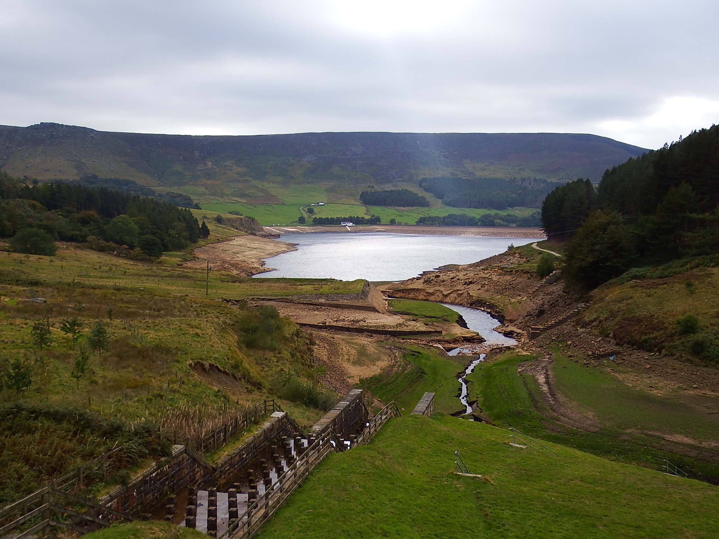
21 members turned up for this historical walk in the “The peak District National Park Saddleworth “led by Merlyn & Joyce.
This area well known by Merlyn from childhood, scouting and Tameside Ranger walks was locally known as Chew Valley Greenfield and latterly “Dovestones “.
Despite the long drive through built up areas we were met on arrival with a beautiful sunny day for the 6 mile walk. The surrounding hills, valleys, rock outcrops, reservoirs, and woodlands were taking on the autumnal tints as we started walking passed “40 ROW “ .These back to back terraced mill workers houses date from 1820 before Greenfield village existed. Below was Greenfield mill and latterly the abandoned Paper mill of Robert Fletcher & Sons 1830-- 2001.
A very gradual ascent followed with stops to view the surrounding hills and monuments, Wharmton transmitter, Pots & Pans war memorial, Alderman Hill. Alphin Pike and Ashway Gap.
We next joined the “Oldham Way” for our journey to Charnel Clough. This route is a Tramway built by Morrison & Mason Ltd from Glasgow who were the engineers contracted for Chew reservoir 1907—1914. The tramway contoured the steep hillside from Micklehurst in Mossley to Charnel Clough to bring material, men and 42,318 cubic feet of puddle clay for Chew reservoir construction. Chew was the highest UK moorland reservoir at that time. We walked along the fringes of heather hillside moorland, through woodland plantations and below aircraft wreck sites at Indians Head. Lunch stop was at Charnel Clough Bridge as it crossed Chew Brook.
Merlyn had photos showing the tramway route ascending the 500 ft. hillside by steam winch to a second locomotive taking the trucks of clay to the reservoir dam.
Downhill now along the Chew track for a 2 mile circular route around Dovestones reservoir quite low due to the hot dry summer. We went through a new woodland path near Ashway Gap house; a shooting lodge built ~1850 by John Platt MP from the respected Oldham textile Company. Tragically his brother James Platt MP was killed in a shooting accident on the hillside above.
The gothic house now demolished for reservoir construction was subsequently used as a hospital in the 1st world war and to billet Italian POW’s 2nd world war.
We crossed the dam admiring the new stone wall between Dovestones and Yeoman Heys Reservoir and then Joyce gave the history of the King of Tonga visit in 1981.
Arriving back at the carpark at 3pm Walter on behalf of the group thanked Merlyn and Joyce for the enjoyable walk with detailed history and events in this location.
Merlyn Young
Walk - Tuesday 9th October
The Walking Group October 9thTuesday walk was led by Sam and Irene Chappell on beautiful warm sunny morning. The group of 14 walkers met on the car park in the centre of Poynton to start the 5.5 mile walk, adapted from the 1998 December edition of the 'Living EDGE' magazine and entitled 'Inclined To Walk'.
Our route followed the spine of a complex colliery railway system, now a quiet wooded path, passing what was Vernon Collieries Office buildings, Albert Pit and the Middlewood Way. We continued up the Incline to the Macclesfield Canal above Higher Poynton where we turned right along the canal towpath, past Canal Pit, Nelson Pit and Vernon Wharf as far as Bridge 16. Here we left the canal and made our way down to Poynton Brook Woods and the Middlewood Way, stopping for lunch at the north entrance to Poynton Coppice. After negotiating a short stretch of path in The Coppice, our route took us to Coppice Road. After crossing the road into fields, we followed the field paths to the junction of Anson Road and Middlewood Road, returning to Poynton past Petra Bank cottages, the Lady Pit pump house and the Poynton Centre, formally the Vernon Schools.
Sam & Irene
Back to Walk Programme
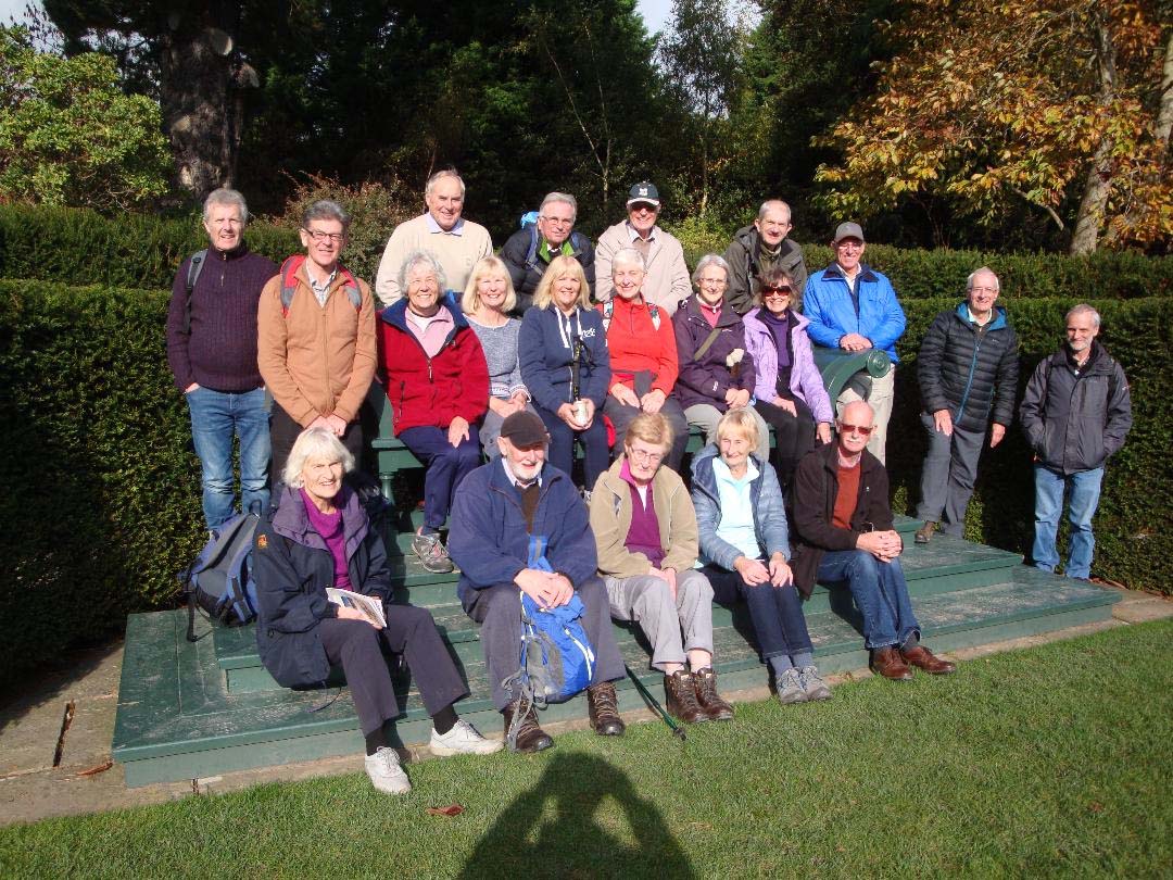
Snowdonia Holiday - 19-22 October
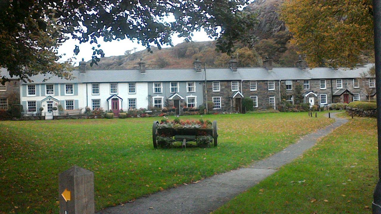
Thirty walking group members enjoyed a three night stay at Craflwyn Hall, Beddgelert, Snowdonia. Craflwyn Hall is owned by the National Trust and leased to HF Holidays, it is set in extensive grounds a mile from Beddgelert. Formerly a Victorian lodge, stable block and outbuildings which have been recently renovated. It proved to be an excellent base for our adventures.
Friday 19th October :
We met at NT Bodnant Gardens near Conwy and explored the 80 acre gardens and woodlands in ideal bright and sunny conditions, enjoying the Autumn colours at their best. After a picnic lunch we made the 28 mile scenic drive to Craflwyn Hall and were made welcome with afternoon tea.
Saturday 20th October :
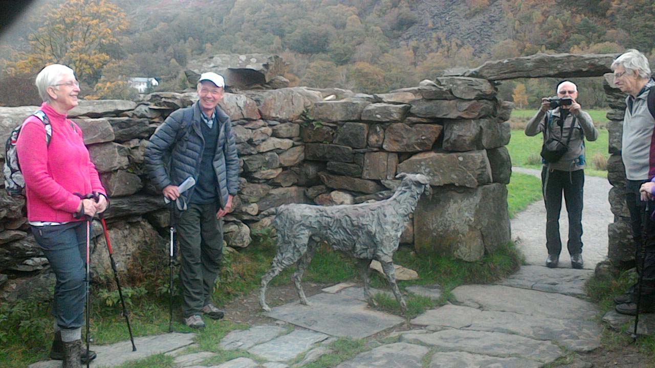
Two walks were planned to provide choice to suit the whole group. Participants started together from the house in favourable weather, walking to Beddgelert and then visited Gelert's Grave and the upper section of the spectacular Aberglaslyn Pass, where a drinks stop was taken by the river. At this point the large group divided into two, Walk 1 led by David Burke and Walk 2 led by Walter Mason.
WALK 1
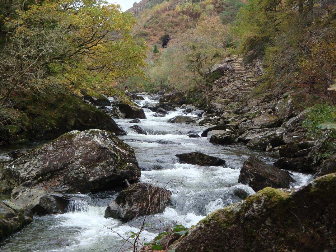
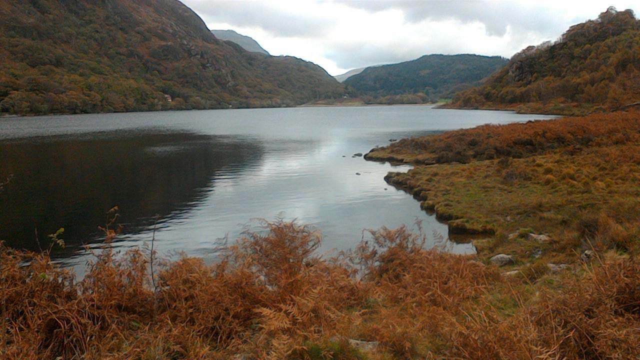
15 members joined David and proceeded down the Pass towards Nantmor, this section of the path was technically more difficult but well worth the challenge. This beautiful, dramatic section of the river is said to be the most scenic in Wales. At Nantmor we left the river to climb into the mountain landscape of Mynydd Sygyn before a panoramic decent to Llyn Dinas and back to the house having covered 6.5 miles.
WALK 2
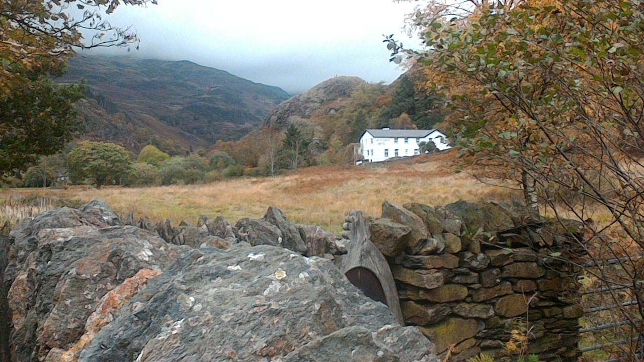
Eleven joined Walter on a lovely 7.2 mile walk in the Aberglaslyn and Gwynant valleys, which avoided the tricky gorge section of the Aberglaslyn Pass. Combining with walk 1, we visited Gelert's Grave and went to the start of the gorge section, then diverged and retreated to follow the other bank of the Glaslyn river. There was time to explore some of the quirky village sights in Beddgelert and have a picnic lunch before continuing on the upper section of the Glaslyn river to Llyn Dinas. On the way we greeted both the late arriving Chappells and the returning walk 1 party, before doing a part circuit of the lake towards Nantgwynant. Although a low level walk on good terrain, there had been plenty of interest and enjoyment, particularly observing the changing woodland scene ranging from tall forest, through lush woodland, to struggling birch and oak woods.
On Saturday evening after dinner, guest speaker Keith Hulse, Mountain Leader, gave a fascinating slide presentation on managing Snowdon and it's many visitors.
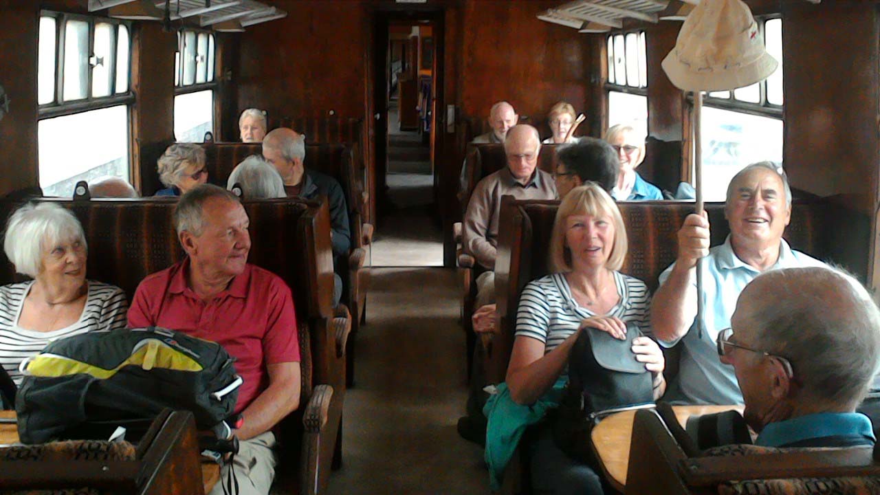
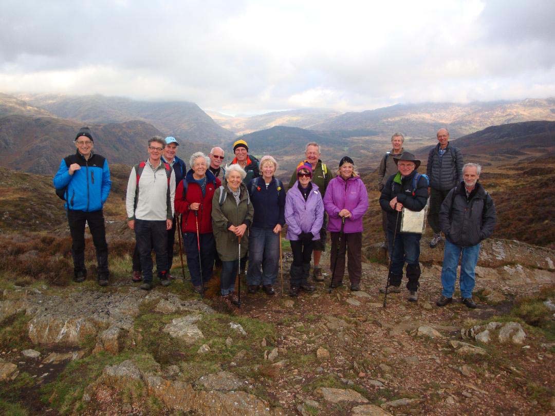
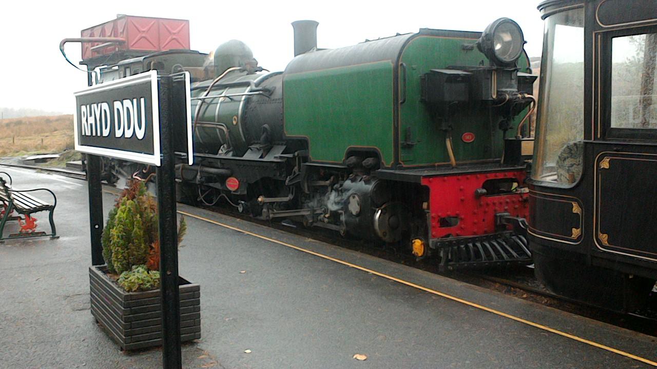
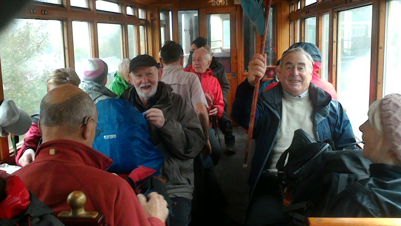
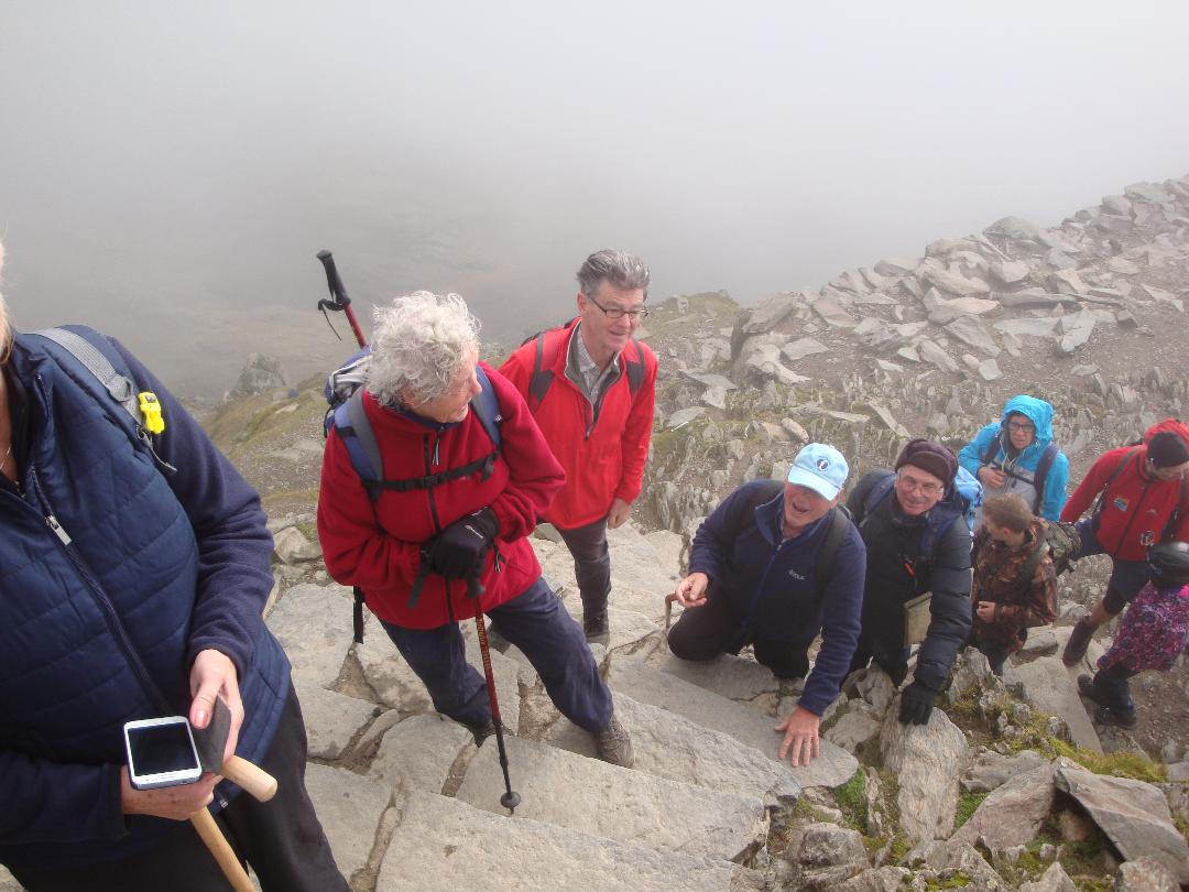
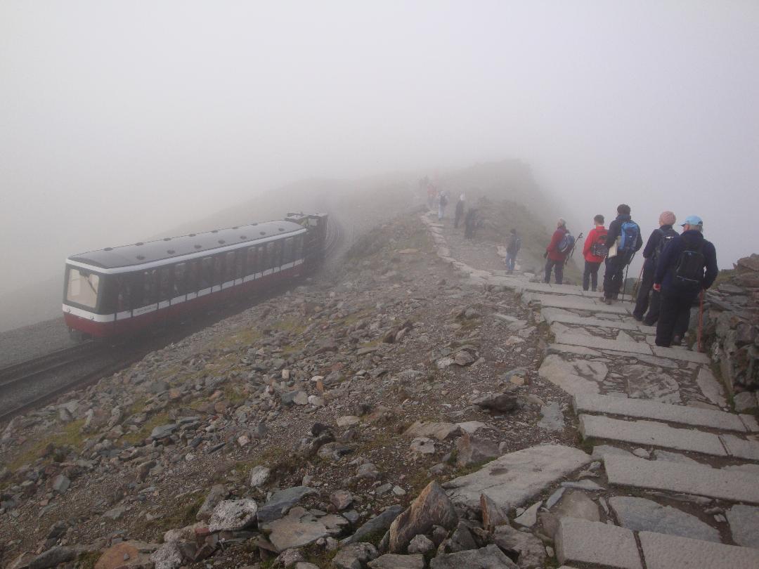
Sunday 21st October : On the rails to Rhyd Ddu We all (30) took part on this linear walk. It started with a steam train journey from Beddgelert to Rhyd Ddu near the western flank of Snowdon, alas we were unable to see Snowdon due to heavy cloud cover which proceeded to dump serious rain on us from the moment we left the train and continued to do so for the next two hours! We walked the 4.9 miles to Beddgelert along the LON GWYRFAI multi user well made pathway through the Beddgelert Forest. Conditions got better later in the day to help our smiles return!
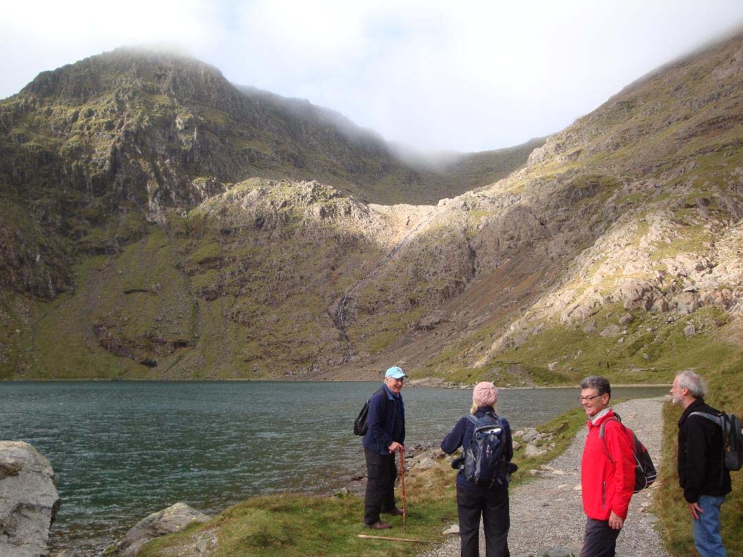
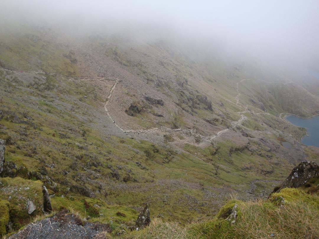
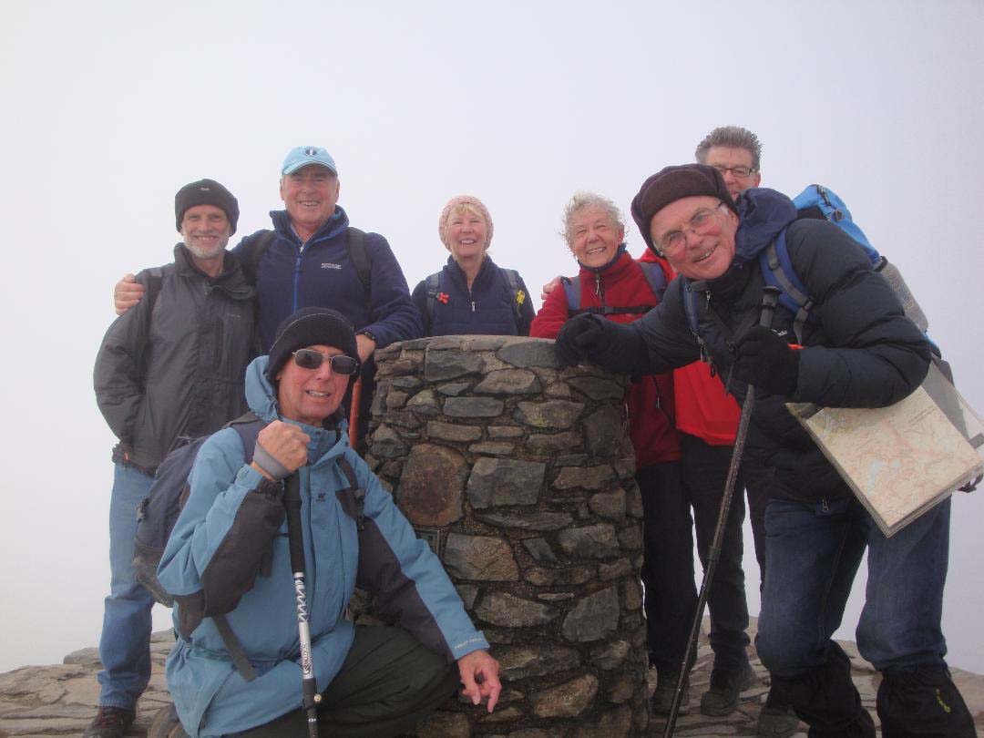
Monday 22 October Self select day : This was a free choice day, one option planned was to visit Snowdon via Pen-y-pass. I am very pleased to report that 7 of our group got to the summit of Snowdon (1085m), a first time for 5 of the group! We made the ascent along the Miners' track as planned and descended along the Pyg Track. The weather was good for walking with sunny intervals and refreshing breeze. It was intermittently misty on top but did clear at times to give stunning views of the coastline, the Lleyn Peninsula, Menai Strait and inland towards Moel Siabod and beyond. A real treat! (see photo at trig. point on the summit)
David Burke
Back to Walk Programme
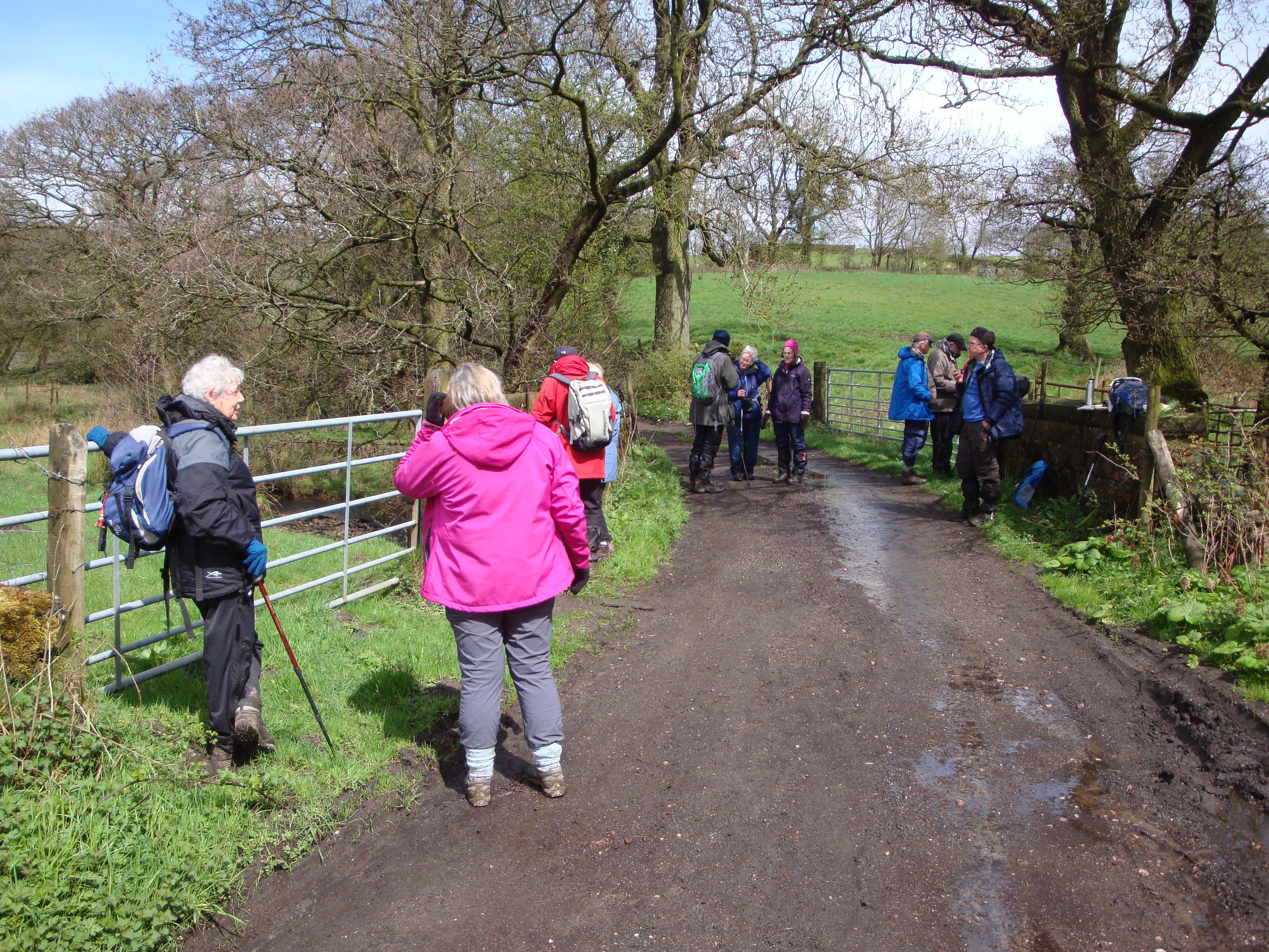
Wednesday 31st October 2018 Adlington and Poynton
Some two dozen of us met in the car park of the Legh Arms for a 7’ish mile walk around the northern half of Adlington Parish. Our walk follows footpaths and other public rights of way around this ancient rural parish and looks at its industrial heritage over the last 250 years.
Exiting the car park we took the London Road, A523, for a short distance before picking up the path along Red Brook and past Adlington Sewage Works, where we swung northwards through open fields towards Adlington Golf Centre. The new Poynton Relief Road will cut one of the golf courses in two and the paths here are being renewed and re-routed as a new golf course and the road are constructed. We stopped for a coffee break at a convenient picnic table and gazebo (’courtesy’ of Adlington Golf Centre). From here we could see the new Avro Heritage Museum as well as the full extent of the housing development on the old Woodford Airfield.
After passing beween the airfield and golf centre we turned east to pass quickly through Adlington Park Industrial estate to reach London Road again at Hope Green. A short hop up London Road brought us back to a path, initially skirting Poynton Industrial Estate then into Hope Lane; a pleasant lane along a stream through woodland. At Hope Lane Cottage we paused for everyone to stroke the donkeys before reaching Wood Lane West at Clayton Greaves Farm.
After heading south on Wood Lane we returned to open field paths to Pedley Hill Farm. Here we rejoined Wood Lane and passed through Booth Green to Roundy Lane where a stile took us (through a holly bush!) to a pleasant little spot by a stream on the edge of a wood where we paused for lunch.
Fully refreshed we headed up the field to meet the Middlewood Way as it passes under Brookledge Lane at Hibbert Brow Farm. A few yards up the lane took us to the Macclesfield Canal at bridge no. 22. So now our rural walk has taken us back in time 250 years to when the proposals for a canal linking Macclesfield to the national network were first mooted. Plans eventually came to fruition around 1824 and the canal opened in 1831 but was sold to the railways in 1846. The Middlewood Way follows the route of the former Macclesfield, Bollington and Marple railway which operated between 1869 and 1970. The canal carried commercial traffic until 1954 and was designated as a Conservation Area in 1975. Both canal and railway are now recreational routes serving a wide variety of leisure activities.
A short but pleasant stroll down the canal to bridge no. 22 saw us take the path back to the Middlewood Way. Here we crossed into open fields again at Barton’s Clough and took the North Cheshire Way west, through Harrop Green Farm into Whych Wood. At Whych Wood the path joins Whych Lane and after passing Whych Cottage took us back to Adlington at Brookledge Lane. After so many whych’es we were worryingly weary, but a left turn onto the lane took us over the railway and back to the Legh Arms!
Ron & Marje.
Back to Walk Programme
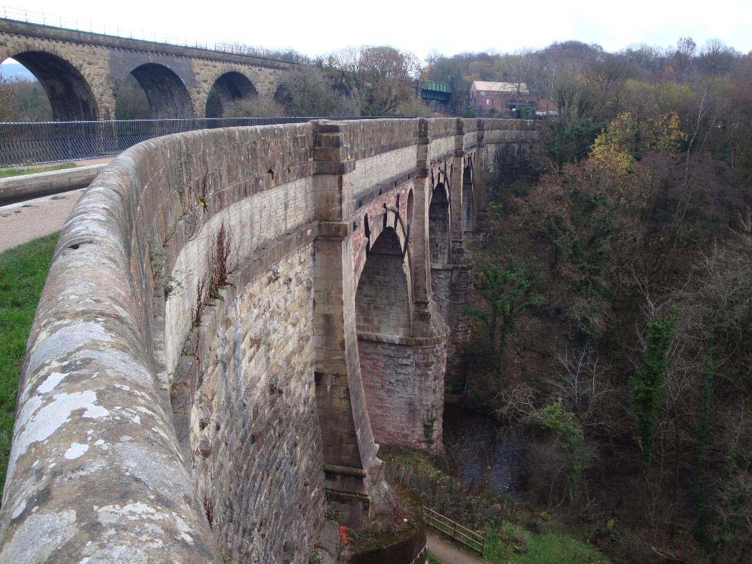
Marple viaduct, circular walk, Wednesday 21st November, 2018
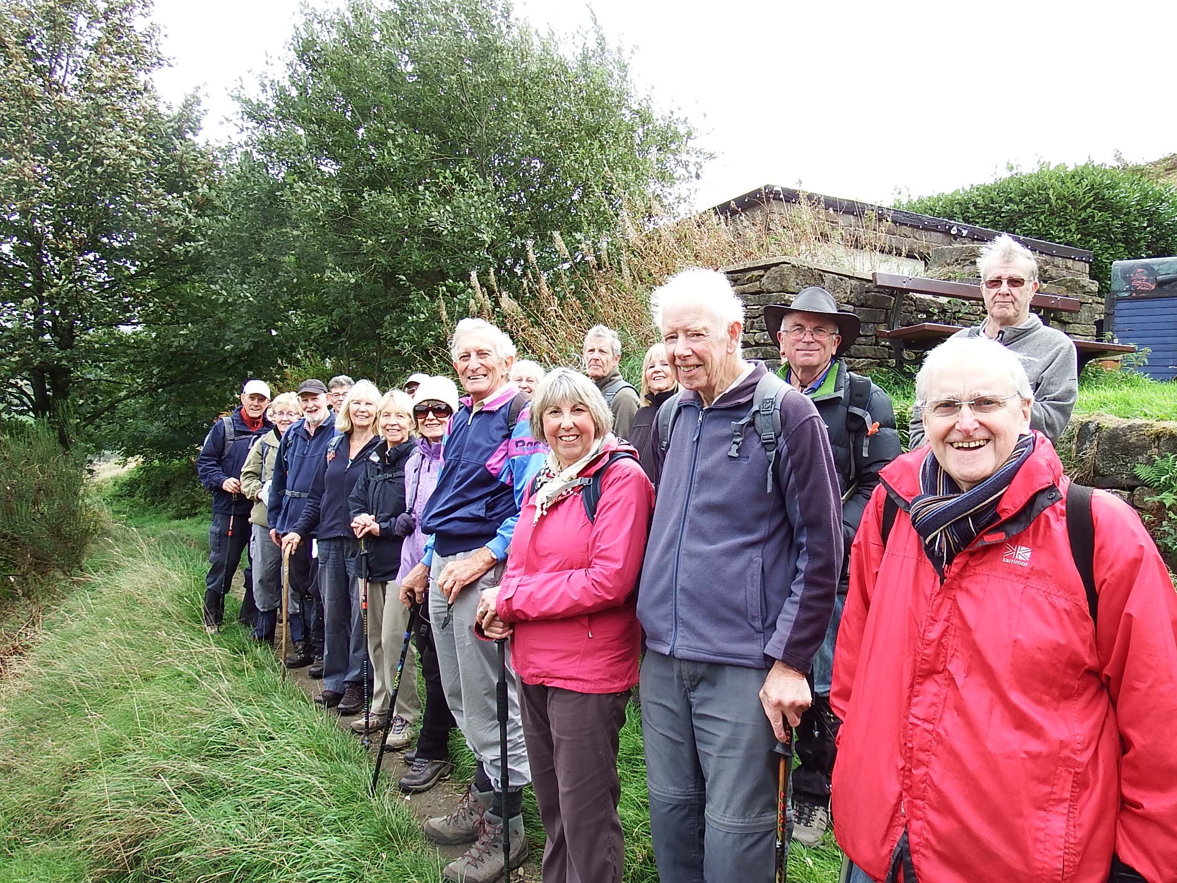
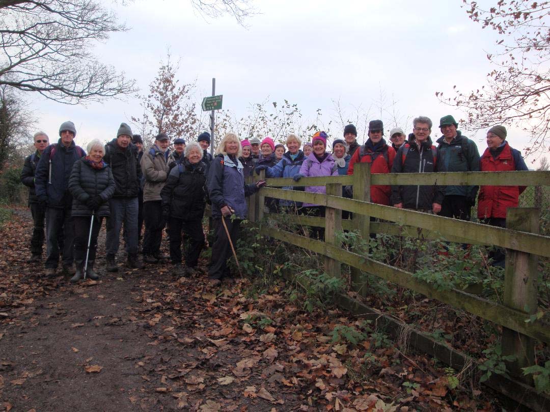
This was a seven mile walk led by Shelagh and Ralph with a total ascent of 1076 feet. It was a cold, dry, but damp, windy morning when 23 of us left the Hare and Hounds public house at Dooley Lane, Marple and 26 returned!
Up the hill, across the A626 road to ascend Higher Danbank. A short way up the road a large white lorry wanted to pass so the walkers at the back squeezed against the hedge to let it by, while those at the front strode on quickly to reach the top so the lorry turn off. Through to a farm track only to be met by a herd of cows, ready for milking, coming towards us. Fortunately Marg, one of the front walkers, had experience of dealing with cows expertly and gently made us a narrow path to one side of for us to pass, it was like an obstacle course with derelict cars, tractors and machinery at one side, moving cows on the other and thick, sticky mud, puddles and cow pats underfoot. The farmer was not perturbed by our presence - in fact we had quite a lengthy chat waiting for all the walkers to make their way through. He advised us that milk prices would rise after Christmas as farmers all over the country were reducing herds due to the low price paid for milk.
We the made our way across a wet grassy field that did an excellent job of cleaning our boots of mud etc. Followed by a grassy pathway to the Middlewood Way and a good walking surface to Marple Golf course. Here we turned off on a path running through the woods, providing protection from the strong winds, to the open path across the fairways to the Macclesfield Canal. On the left was Goyt Mill built in 1905 which is debateably the most southern cotton mill - mills south of here being silk mills. We turned off at Hawk Green to have our coffee break at the tables outside the Crown Hotel (unfortunately not open at 11.15 am). They had previously generously allowed us to use them. We were joined by a further three walkers who for some reason did not want to do the first two and a half mile 475 feet total ascent challenges.
After refreshments we made our way up the Ridge to enjoy some views, not at their best in the cloudy weather but still worth seeing. We made our way along the Ridge and down to the Peak Forest canal enjoying some very atmospheric views of misty hills, then a short walk alongside the canal before turning off uphill to Marple, to enjoy some distant hill views. Walking down Marple locks (the locks lift the boats 209 feet using 16 locks) for lunch at the picnic area, we mistakenly walked past two benches looking for the five that were there when the walk was tested ten days earlier. So we had lunch on the sides of the canal bridge. It was intended to play two audio clips using a mobile and portable speaker, but the group was too dispersed and cold so it was abandoned. They and other audio clips can be listened to by downloading the Oldknow’s App.
After a short lunch break we moved on over Marple Aqueduct. This is the highest aqueduct in England being 100 feet above the river Goyt and 209 feet long. We moved along the Peak Forest canal leaving at Hyde Bank Bridge following the path the horses took over the hill while the boatmen “legged” the boat through the tunnel. We soon turned off through some ancient (established before 1600) woods of mainly native species of oak, ash, holly and hawthorn trees. We ended up at a detour point for a ten minute extension to look at Chadkirk Chapel but there were no takers. We moved on using very good paths and views alongside the River Goyt before the sting in the tail, a 100 feet climb in 300 yards. We then meandered back with some interesting views through trees to Chadkirk industrial estate and Wyevale garden centre before reaching our starting point the Hare and Hounds public house.
Shelagh and Ralph.
Back to Walk Programme
Christmas Walk Wednesday 19th December 2018
Whitehough, Eccles Pike and Christmas lunch at The Old Hall
33 walking group members turned out for our Christmas walk, led by Alison and Brian Allerton, 29 stayed for lunch at The Old Hall. We occupied the main room, overlooked by a minstrel's gallery and enjoyed a worthy Christmas lunch.
The walk route, modified slightly on the day to avoid a troublesome muddy section, involved one warming climb from Whitehough, up the northern flank of Eccles Pike, to join the horizontal path westward, which provided exceptional views of the whole valley from South Head to the East, Chinley Churn to the North and the distant skyline of Manchester, etched clearly in the sunshine, to the West. We left the horizontal path at Portobello, enjoyed a coffee stop (with liqueurs) and descended to Buxworth Basin where we joined the old tram line leading back to the Old Hall carpark at Whitehough. Approximate distance 4 miles.
David Burke
Back to Walk Programme