|
We usually meet on the last Wednesday of each month and on the second Tuesday of every other month, at 9:30am by the village hall. Walks are not long or strenuous; 5 or 6 miles on average, each with a different leader.
Group Leader David Burke
2019 Walk Programme
WALK REPORTS
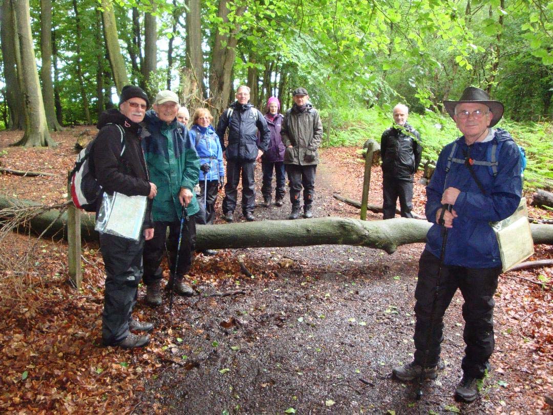
Walk report – Tuesday 8th January
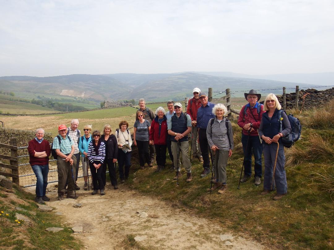
Unusually, today's walk started and ended at the Village Hall, with a pub lunch included. Jeff Mortimer led thirteen of us through High Lane village to pick up a footpath at the Woodside Tennis Club. We then walked by the primary school and recreation ground to cross the railway line and pick up the Goyt Way footpath. This took us by Elmerhurst Cottage and then along a track towards Platt Wood Farm. Here we took a climbing path to enter Lyme Park over a ladder stile. Crossing the west edge of Lyme Park revealed lovely views of Manchester and the Cheshire Plain. We left Lyme park at West Parkgate and then traversed some fields to pass near Keeper's Cottage and then on to Birchencliff, which is an unusual hamlet, now converted to holiday lets. After this we proceeded along Shrigley Road to pick up a path at Harrop Brow, passing Lockgate Farm and then on to Middlewood Way. At the site of the old Higher Poynton station some of us ate a packed lunch while most of us went to the nearby Boar's Head and enjoyed a pub lunch and some liquid refreshment.
After lunch it was simply a leisurely walk along the canal towing path to the Bull's Head in High Lane and then back to the Village Hall.
Jeff Mortimer
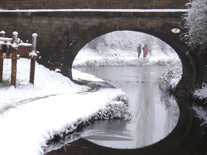
Walk Report - Wednesday 30th January
There had been heavy snow overnight so only five of us turned up at the Village Hall car-park.
The walk was to be led by Rick Hedley who had planned to start and finish at Hague Bar car-park near New Mills. However as the road there was steep and winding and would probably be covered in ice, we decided to postpone that walk, and instead start and finish in High Lane.
Most of this walk was along the canal tow-paths. Initially along the Macclesfield Canal to Marple where we stopped for coffee and photos. We then followed the Peak Forest Canal south crossing a bridge to take a path through Stanleyhall Wood to pick up a track to Lea Cote Farm. Here we followed footpaths accross fields to Windlehurst Hall flats , then along a path adjacent to the canal to emerge at Andrew Lane where we again found the Macclesfield Canal tow-path. We did not however return to the car park, but continued under the A6 to the Bull's Head, where we enjoyed a welcome pub lunch and drinks.
Jeff Mortimer
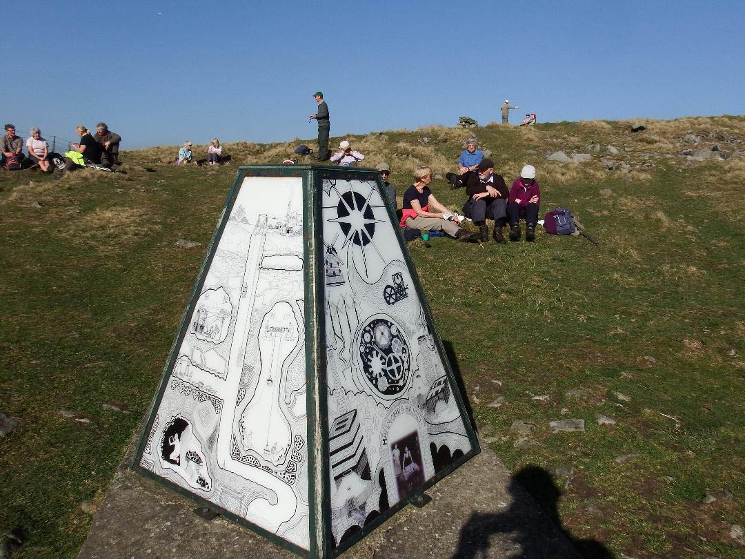
Walk Report -Wednesday walk 27th February
A beautiful day and an excellent turnout of 25 people.
We started the walk from the car park in Lyme park and made our way up to Bowstones Cottage where we paused to get our breath back and look at the bowstones. We then carried on along Gritstone Trail past the trig point on Sponds Hill to the view point where we stopped for coffee. After that, retraced our steps back to follow the park boundary downhill and cut across to Bakestone Moor. On route we passed by the capped off entrances to two disused coal mines.
A short climb took us to an obelisk depicting the information of the coal mines in the area. We stopped for lunch in glorious sunshine. We then made our way down to Keepers Cottage and on to the west gate of Lyme and from here back through the park to the car park.
An excellent day covering 7 miles.
Jeff Robinson
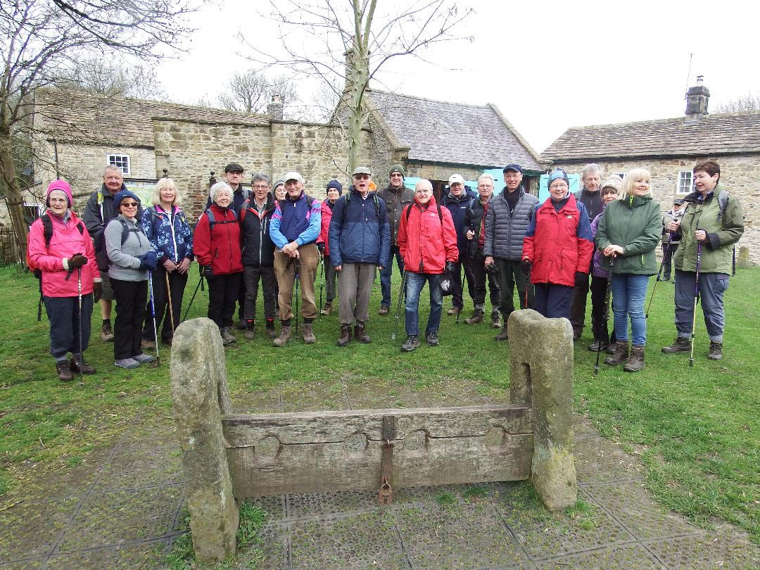
Walk Report - Wednesday 27th March 2019 Foolow and Eyam, Derbyshire.
Mike and Sandra Moran led a group of 22 on a 6 mile amble in Derbyshire on a pleasant bright dry day. We parked on the green by the duck pond in the lovely Derbyshire village of Foolow and followed field paths to the famous plague village of Eyam, where we enjoyed a coffee stop on the village green by the old stocks, everyone was on good behaviour so we had no use for them! Our onward route followed a bridle path and field paths which eventually circled round back to Foolow village. Some of the group enjoyed a remarkably good quality/value lunch in the welcoming Bull's Head pub, well worth another visit.
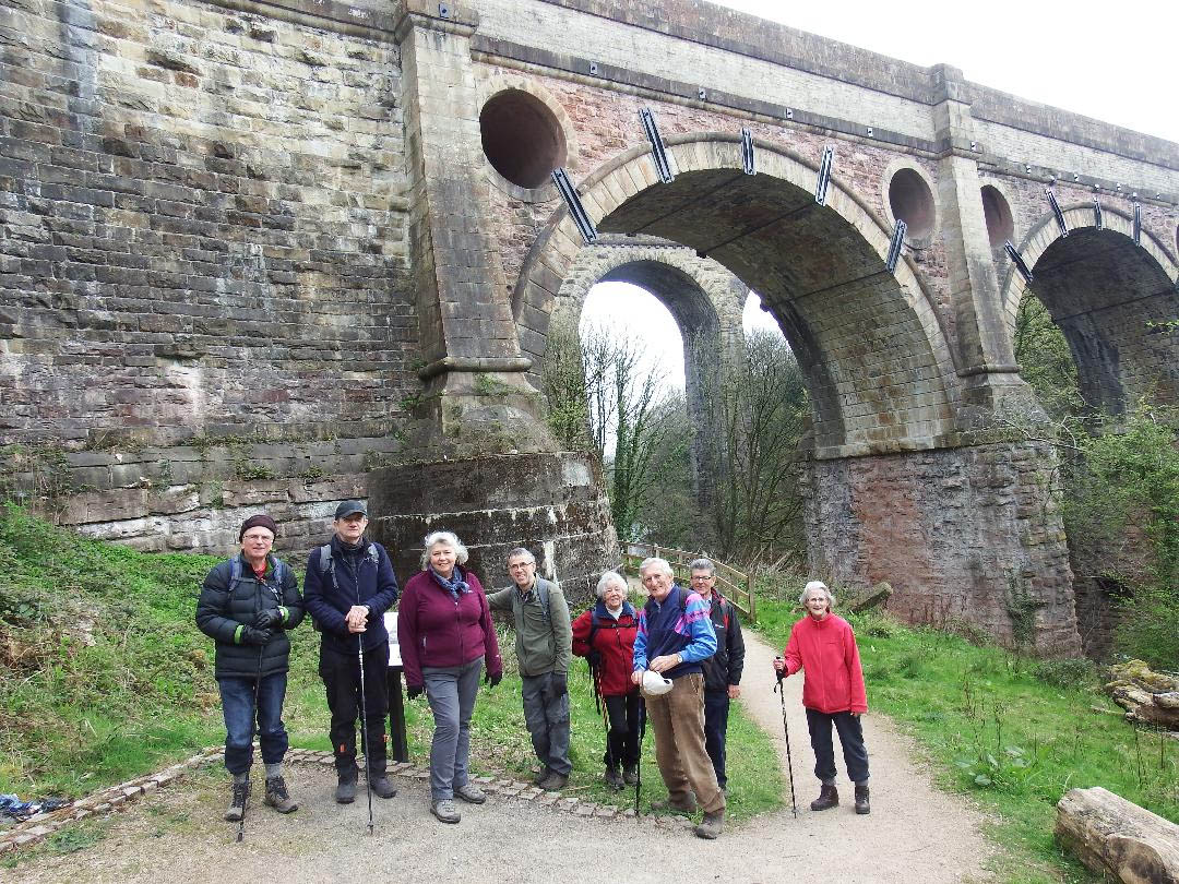
Walk report - Tuesday 9th April 2019. Marple, Compstall, Werneth Low, Etherlow Country Park
Nine of us set out on a beautiful sunny but deceptively cold, spring morning from Brabyns Park in Marple. From the canal side we descended under the aqueduct and viaduct and then followed the River Etherow and some very, very muddy paths through the wood into Compstall. After a short coffee break we began the steady climb to the top of Werneth Low where we admired the views over Cheshire, Derbyshire, Lancashire and Yorkshire. Following a civilised lunch break at picnic tables we descended through fields and woods to Etherow Country Park where the weir and mandarin ducks offered ideal photography opportunites. The final stage of the walk was back through the centre of Brabyns Park to complete the circle.
Shelagh Stokes.
Walk report - Wednesday 24th April 2019 Sett Valley, Hayfield
19 folk met in Birch Vale for the 5 mile Mystery Walk. The group walked down the Sett Valley Trail via Bluebell Wood (with strong perfume from the blue bells) towards Hayfield where a coffee break was agreed,picnic benches available. Crossing the bypass into Hayfield behind the church over the river and diverting off road down the calico trail to School Field. A little road walking, passing stone cottages (chatting to a lady in her garden with large black dog) and then upward until reaching the lower slope of Lantern Pike, with views of Little Hayfield and Kinder Scout. Despite breathlessness everyone made the ascents. The group then veered off left away from the path leading to Rowarth for yet another ascent, on reaching the top with magnificent views, we sat down for lunch in a slight breeze and hazy sunshine. Of course, downward was our next challenge with track, road (named Stitch Lane)and path - a steep decent to the Sycamore Pub and our parked cars.
Ruth Smith
Walk report - Tuesday 7th May 2019
Sam and Irene Chappell led a small group of 9 walkers on a 5.5 mile walk from Bollington on a cloudy but pleasant day slightly warmer than the weather we had over the May Bank holiday. The walk started from the car park in the centre of Bollington and went along the canal towards Macclesfield for about a mile and a half passing some interesting canal side features and gardens. Our route took us away from the canal at Hurdsfield passing Jenny's farm and on to Higher Swanscoe Farm and Kerridge Road for a short distance before passing the entrance to Swanscoe Hall. The next section on field paths passed a number of farms and then on to Windmill Lane
There were two major items of interest to see along the Windmill Lane Victoria Bridge and Clayton's tower.
Victoria Bridge crossed the inclined plane that marked the top of the Rally Road' . There were two tracks up the incline where trucks were hauled up empty and lowered down loaded with stone. A steam powered winding drum at the top provided the motive effort via cables. It is thought that there were tracks along some parts of the lane in order to bring stone from other quarries.
Clayton's Tower , beside Windmill Lane , appears to have been a chimney top for a furnace lower down the hill, although inspection in 2009 showed no sign of soot. Neither is there a shaft beneath the tower so that it never served as a ventilation shaft for local coal mines.
From here the walk continued behind the cottages, through the gardens for our lunch stop with a view and across and into Kerridge. Passing through the village we then returned to Bollington and the car park.
Sam & Irene Chappell
Walk Report: Wednesday 29th May 2019 Derbyshire Dales
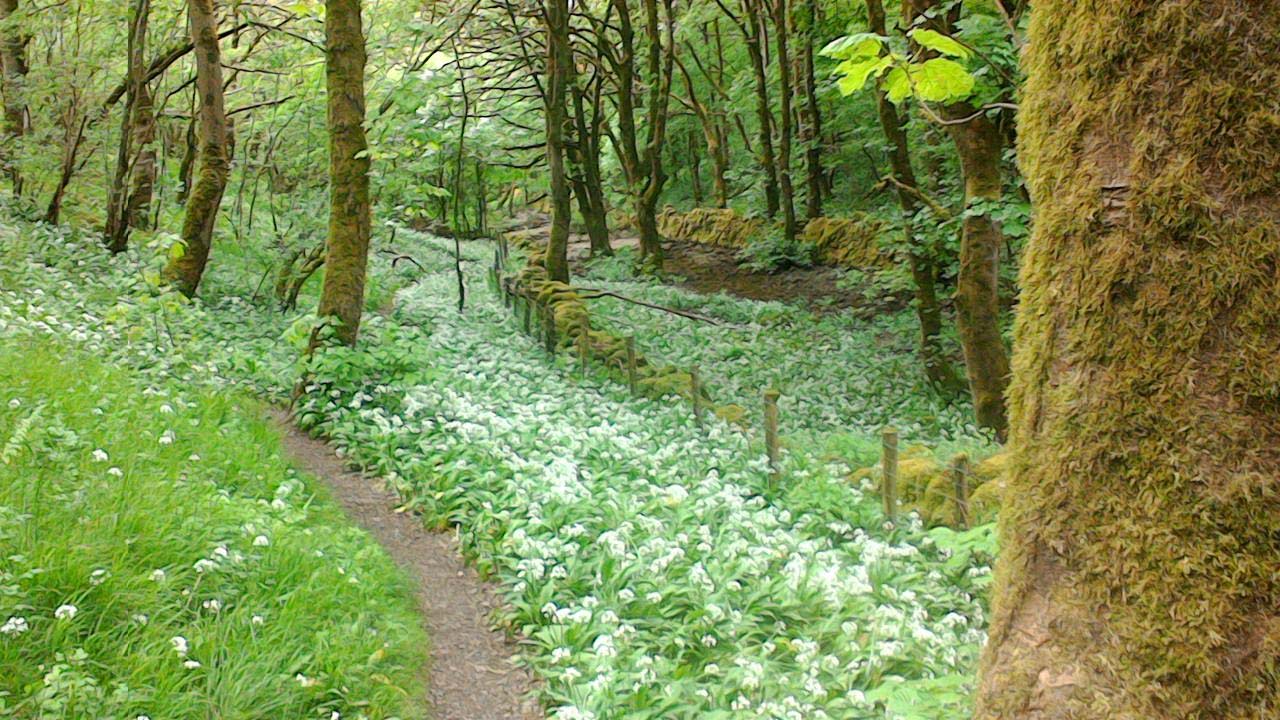
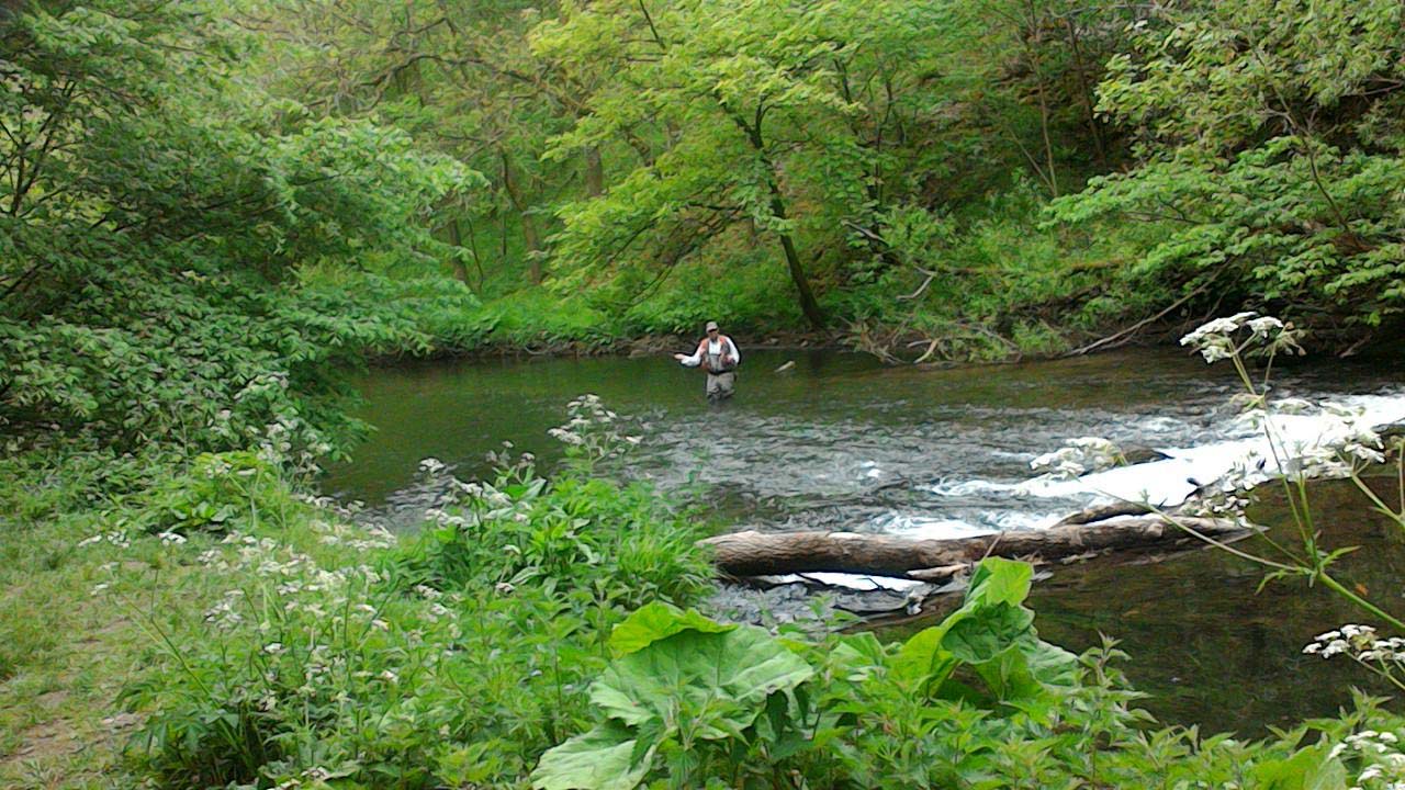
In late May, this 7 dales walk (Litton,Tansley, Cressbrook, Ravensdale, Water-cum-Jolly, Millers, and Tideswell Dales) was a visual delight. Wild flowers were in abundance - early purple orchids, cowslips, wild garlic, bluebells, rock roses, cuckoo flowers, stitchworts - and there was local interest from lambs being fed, from fly fishing, and from the ever varying scenery.
The thirteen walkers did have to tread carefully at times in the limestone paths of Tansley and Cressbrook Dales, but elsewhere the paths were flat and easy, and the threatened rain never materialised.
By common consent the walk was diverted along Water-cum-Jolly Dale, rather than the Monsal Trail tunnels.
The 6 mile walk was particularly poignant for Ron Barrow, who was born in the cottage block which used to stand on what is now the Tideswell Dale car park. It was also good to welcome back our group leader David after a short period of absence.
Walter Mason
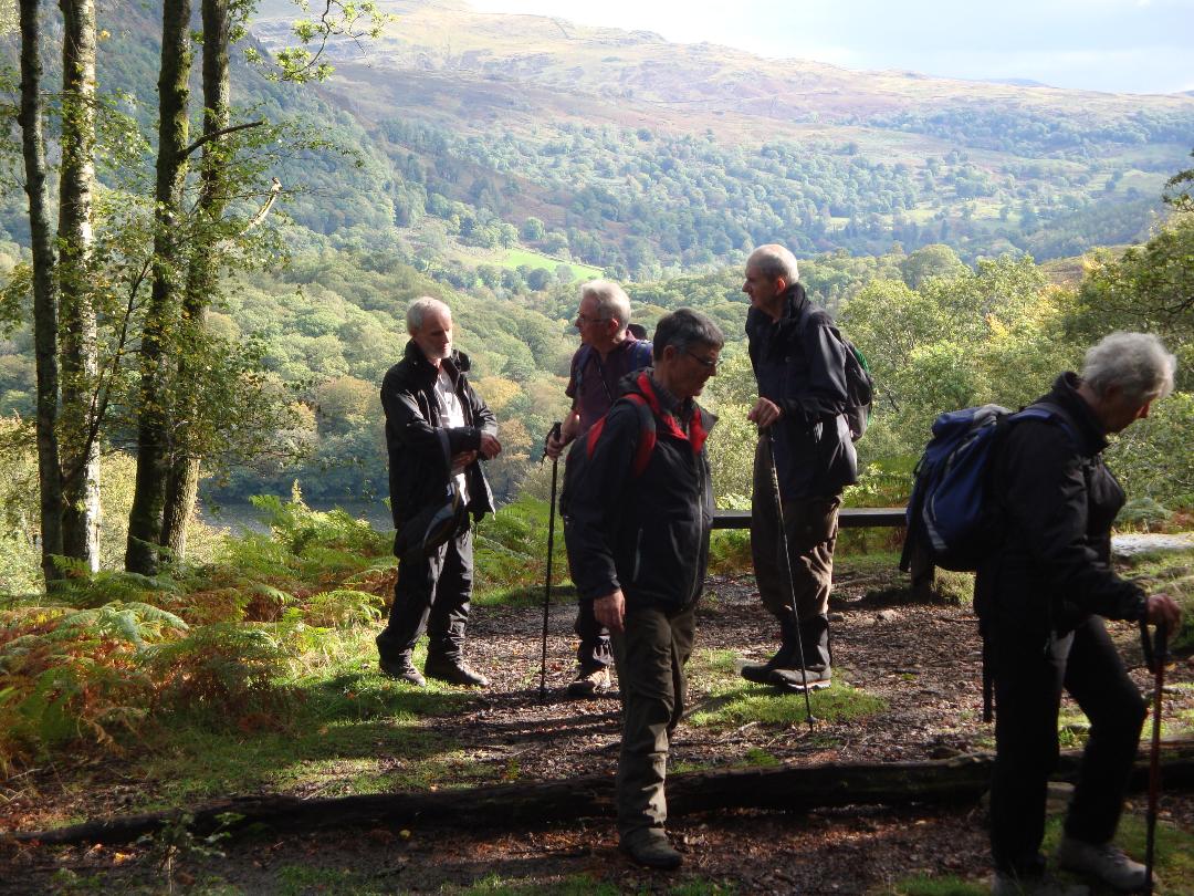
U3A Walk: Tuesday 11th June 2019 Alderley Edge
Despite a not very good weather forecast but 10 brave people turned out for the walk round Alderley Edge. The walk started from the National Trust car park at the Wizard Alderley Edge.
In the rain we made our way up through the woods which gave us some shelter, eventually climbing slightly to pass the remains of the old copper mine. From here we carried on round to the Edge and a mud-stone rocky outcrop where we were exposed to the wind and rain, but still had reasonable good views.
The path then continued back through the shelter of the wood and past the site of the Armada Beacon before doubling back on itself and passing the Wizard's Well. We followed the path past the backs of large houses and made our way down Macclesfield road before taking another path to the left.
After a short coffee break under the shelter of a large tree we continued to Artists Lane and eventually crossing various fields to reach the cobbled track of Bradford Lane. The route continued over the fields on good paths in relatively dry conditions to cross Finlow wood and a short distance brought us past a very large mansion house back to the starting point.
A very good 5 mile walk, despite the weather.
Jeff Robinson
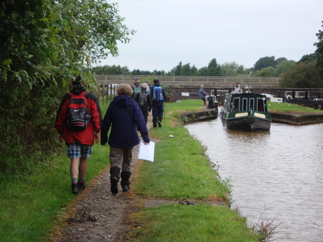
Walk report - Malkins Bank 31st July
Our 6 mile walk took us along the canal and then through rolling farmland and pretty wooded valleys. This area once contained a thriving salt industry due to large underground deposits which, once extracted, were pan dried and then sent by train (the salt line) to the Potteries.
Nine of us met at the now defunct salt line carpark and set off along the Trent and Mersey canal (part of the Cheshire ring) with its unusual sets of twin locks built by Telford and Brindley. A steady stream of boats was going through the locks.
At Wheelock we left the canal where we had to make a slight detour as the recent heavy rain had left our original route waterlogged. However, we were soon able to get back on track at Sandbach mill and without getting too bogged down were able to complete the original route.
What we hadn't catered for was the freak weather conditions which had resulted in flooding, road closures and diversions in the Stockport area, both in the morning and on our way home. We hope those who braved the conditions thought the walk worthwhile!
Louanne Collins
Walk report Tuesday 13 th August 2019 Hayfield /Little Hayfield Walk
Merlyn and Joyce led 16 walkers on a historical walk from Hayfield to Kinder Reservoir, the shooting cabin on Middle Moor returning via Park Hall and Little Hayfield.
We followed the route of the Kinder reservoir construction railway, up through the village along the river Sett. Old photos were circulated of the train route dating back to the reservoir construction from 1903 to 1912.
At the reservoir dam we stopped for coffee admiring the views of surrounding hills rich in purple heather. Joyce gave a historical summary of Upper House sited in woodland above the dam: and its former owner Sir James Watts a Manchester Textile merchant.
Refreshed we followed the reservoir path through muddy sections and high bracken to Williams Clough and then followed the gradual heather clad diagonal path up to Middle Moor. A red grouse scurried along the pathway in front maybe avoiding the shooting season!
Lunch was taken on a sheltered heather bank in sunshine on the moor overlooking views of Chinley Churn, Lantern Pike, and beyond. Walters's grandchildren who accompanied us on the walk finished lunch quickly and picked small bilberries in nearby cloughs.
Return was via Park Hall to see the recently cleared wall garden and then though Little Hayfield. We took a seldom used path following a tributary of the river Sett back to the village.
Merlyn Young
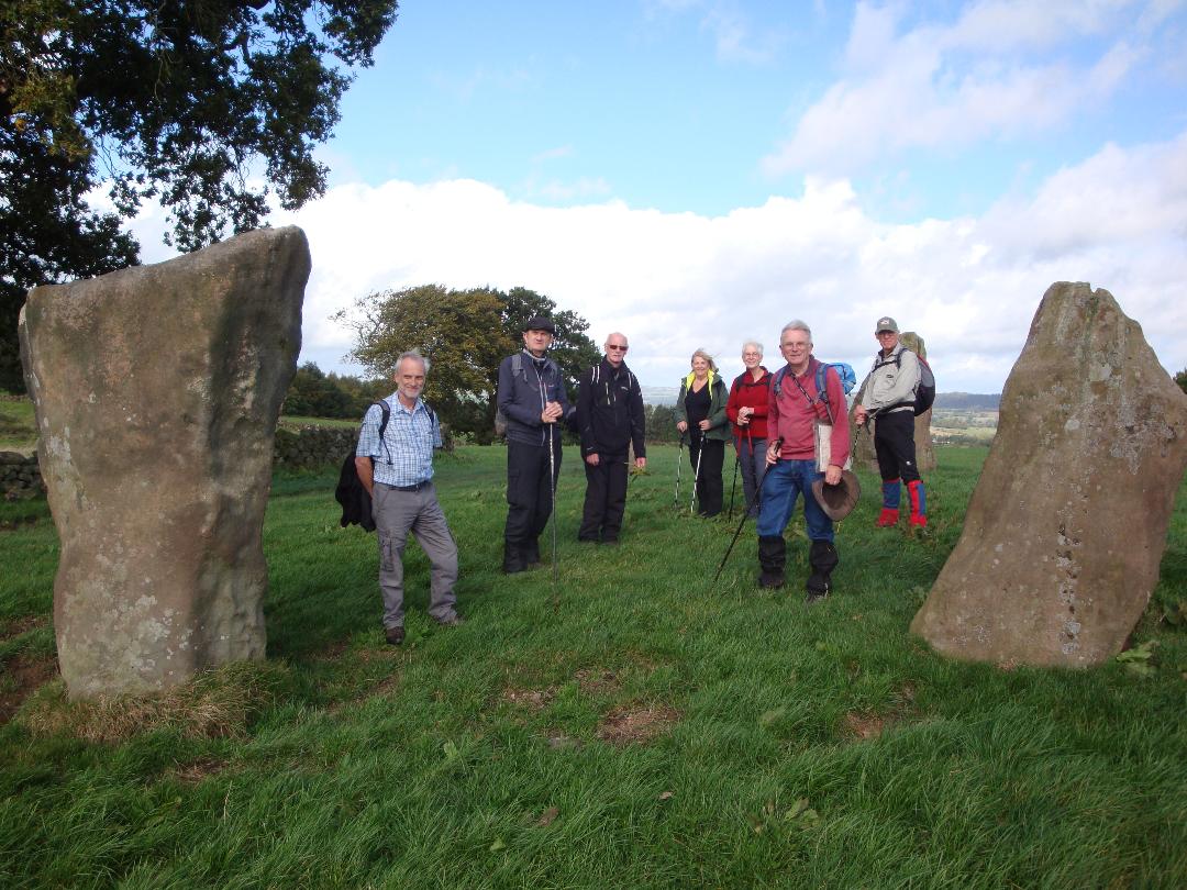
Walk report - Winster and Stanton Moor
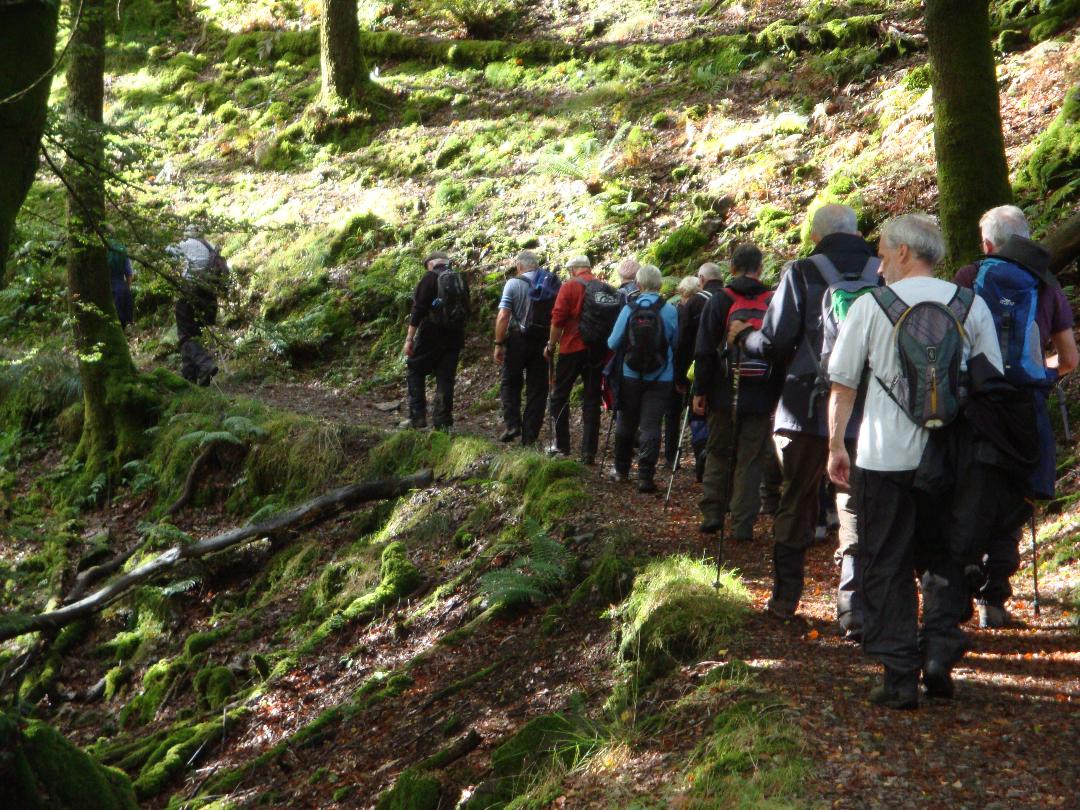
Eleven of us met in the public car park to the south of Winster for a roughly 6 mile walk up to and around Stanton Moor. Lead mining, probably dating back to Roman times, boomed in the 18th century with Winster becoming one of the largest towns in Derbyshire. Stanton Moor, a Scheduled Ancient Monument, is a mystical and isolated gritstone mass, covered with antiquarian sites and quarries. Our walk began in Winster with its fine architecture and steep quaintness, before climbing up to Stanton Moor and delving into its mystery and secrets of earlier times.
We set off from the car park across the common, immediately passing the capped off shaft of Wesson Mine, before descending to Main Street via one of the many jitties (narrow footpaths) past well kept gardens. Having noted in passing the Wesleyan Chapel, Bank House, Burton Institute, Dower House and Winster Hall we reached the Market House, where we turned left down Woodhouse lane onto a gently downhill path. At the bottom of the escarpment we began our 200m (700ft) or so ascent to the South East corner of Stanton Moor. The climb was moderate for the most part, but we paused for a coffee break and to turn and take in views back down to the valley bottom and up to Winster, before tackling the short, but steepest, 50m rise through a small scrub wooded area. Continuing the more moderate climb we passed through the camping and caravan park at Barn Farm to reach the lane running along the southern edge of Stanton Moor.
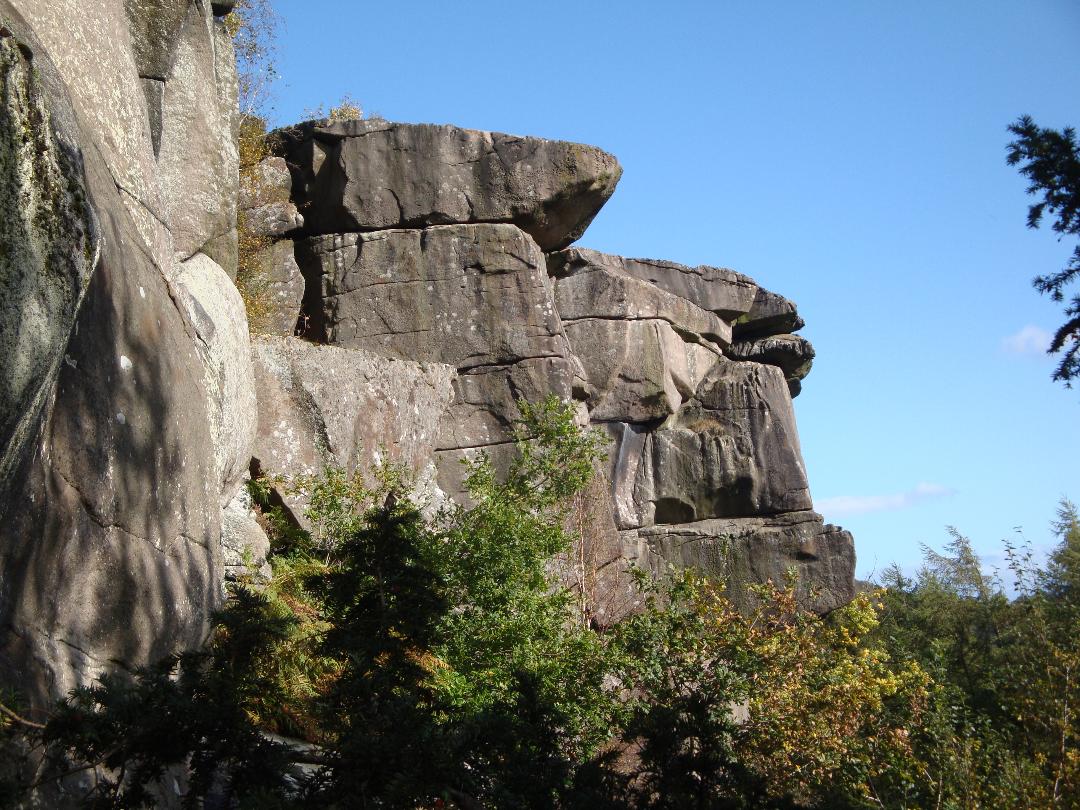
After a dry start the predicted rain arrived shortly before we made our way onto the Moor. Here we decamped to a wooded dell with a convenient flat rock outcrop for a welcome but damp lunch. Refreshed we set off along the eastern edge which falls away sharply exposing dramatic weathered gritstone shapes and views of Darley Dale and Matlock. We visited the first of the notable named rocks, the Cat (contraction of Cath meaning battle) with its enigmatic carving. This was followed by a look at the Reform Tower, erected in honour of Earl Grey's steering of the Reform Act. It is worth noting that the silver birch tree clumps dotted around the moor have only grown up over the last 50 years. During the early World War I period the coniferous plantations of larch, spruce and Scots pine, which then covered Stanton Moor, were systematically felled to produce trench timber for shipment to the battlefields of Europe. This was reportedly carried out by the First Royal Canadian Women's Forestry Corps. The moor contains numerous burial cairns and stone circles dating back 3500 to 4500 years, the majority of which are barely, if at all discernable under the covering of grass, heather and bracken. We inspected the only one feature remaining in something like its original form, the Nine Ladies Stone Circle. This 50ft diameter ring and solitary outlier, known as the King Stone is all that remains of a burial mound. The fanciful name is said to come from a much more recent legend of nine ladies who were turned to stone for dancing on the Sabbath, while their fiddler is now the lonely King Stone. Reflecting on the cremated remains of hundreds of people beneath, we descended gently southwards back down the centre of the moor with panoramic views to Youlgreave in the west, Winster and Matlock in front and Darley Dale to the east (albeit slightly marred by the now easing rain). Nearing the bottom of the moor we took the path sharply right to exit the moor below the numerous disused quarries that mark its western edge, passing another notable rock know locally as the Cork Stone for its resemblance to a champagne cork.
After a short walk down Birchover Road we reached the entrance to the one remaining working quarry, Stanton Park. Here we turned right and exited through the rear of the quarries car park into a wooded ridge running behind the village of Birchover. Following the gently descending path we emerged back onto the road at the other end of the village by the Druid Inn. Birchover, strung out along a main street has grown up over the last 300 years mainly to house workers from the nearby quarries. Taking the lane at the left of the inn we passed the small outcrop known as Rowter Rocks. As the name of the inn implies there are tales of ancient religious activities and magic being performed on this weathered and now tree covered outcrop. The real magic of this place is the work of The Rev. Thomas Eyre, who built the first chapel below the rocks. He carved seats and caves into the rocks where he spent much time entertaining friends and writing sermons. We continued down the lane to just beyond Rocking Stone Farm where we looped back along the top of the ridge, below Birchover and above Birchover Wood into Uppertown, a tiny hamlet on a quiet lane back to Winster. A few hundred metres down the road we took the path left through fields to the bottom of the valley and rejoined our outward route for the last half a mile up to Winster and back to the car park on East Bank.
It's hard to imagine that the quiet, rambling roads of Winster or the wild heather clad Stanton Moor have ever been touched by the hands of industry. What we saw on our walk today, though, is a reminder of how time can wear down and reclaim scarred landscapes.
Ron Rennell
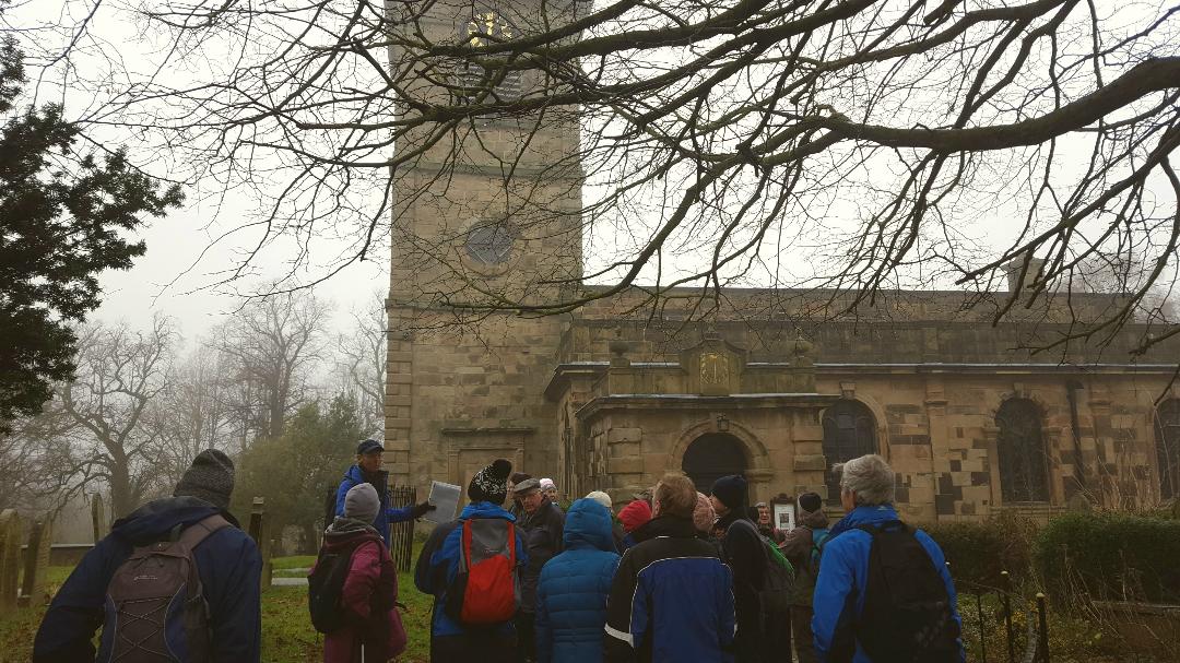
Walk Report - Wednesday 25th September. Combs, Chapel-en-le Frith
GRASMERE WALK WEEKEND 27-29th September 2019
The 13th walking group mid year break returned to Grasmere after a 12 year absence. The venue Glenthorne Quaker Guest House is not as grand as some of our venues have been, but it is ideally situated just below Wordworth's former home of Allan Bank, yet still only a short stroll from Grasmere centre. It also has a simple charm of its own, with a reserved dining area and lounge for our evening entertainments. Accommodation and meals were adequate without being exciting.
A horrendous weather forecast proved accurate as we aquaplaned up the M6 to the planned Friday walk from Sizergh Castle. Umbrellas supplemented wet weather gear, and wellington boots would have been handy as some National Trust paths were well laid, but below the water table! One of the best views in Cumbria was shrouded in mist, and first port of call at Glenthorne was the drying room! But it wasn't all bad. Much of the 3 4 mile route was on good paths through lovely woodlands, and Helsingham church at the viewpoint was very pleasant and made a handy lunch stop! The car park at Sizergh was handy for loos, hot drinks and a quick look at the Castle's treasures before travelling on to Grasmere.
The pessimistic forecast for Saturday miraculously transmuted into a fine day for walking, and soon after 10am our party of 22 was ready for action. As on Friday, Walter had prepared the route, this time a 7 mile narrow loop on the west side of Grasmere and Rydal Water, with an optional short steep climb up Loughrigg Fell for any keen ones. A few of our group had already decided on a shorter lakeside walk. The early sun and previous day's rain made for a muggy start and the main group soon realised they were overdressed in unnecessary wet weather gear as the walk ascended into the lovely beech woods of Red Bank, with tantalising glimpses across the lake and beyond. Two stretches of track were awkwardly stony and needed care, but then we reached Loughrigg Terrace and decision point.
One by one the number of keen ones increased until a group of 11 started up the steep slope, first to reach the viewpoint of Grasmere Cairn, and eventually Loughrigg Fell summit 335m/1101ft. This has one of the finest panoramas in the Lake District, and was only partially reduced by distant showery mist. The 11 were delighted with the view but perhaps less delighted by the steep downward path!
Meanwhile a smaller group of 6 ambled along Loughrigg Terrace and then along to the Loughrigg Quarries to await the keen ones and have the lunch stop. These man-made caves are a real surprise and extend well into the hillside. Stepping stones tempt small boys/girls and grandparents alike, and Ed, Sam and Ralph disappeared into the recesses of the upper cave, eventually to re-appear with big smiles on their faces!
After a briefer look at the lower cave complex, we moved into a higher gear, as the paths were firm and less stony, and the sunshine was hotting up. A track below Rough Intake took us to Cote How, to turn down steps to Rydal, with another turn onto a good lakeside return path by Rydal Water. Good path or not, it was in places flooded by the high water level. Here were plenty of people, including Cambridge undergraduates having a pre-term competition to solve clues left by the paths. A heron stood silently on a lakeside rock, unmoved as we passed. Here, as with most of the route, there were lovely everchanging views.
Briefly leaving the lake the path ascended, then a sharp right took it down woodlands and over River Rothay by a modern bridge. After a short loo stop, then a group photo, a good smooth track followed the river upstream and through Penny Rock Wood, where we recrossed the river and now followed the vagaries of the return lakeside path as far as The Lea. We turned up to the Red Bank road, where a right turn headed the group along to Tweedies and a welcome drink, with still enough time for afternoon tea back at Glenthorne.
Saturday had been a very satisfying day, just as well when on Sunday the monsoon rains reappeared, and by common consent sent us homeward bound without a walk.
Before that, the evenings had been enlivened by Walter's quiz challenges, 6 in all. Taking advantage of the guesthouse piano, one evening quiz involved identifying ladies names from piano pieces, while the second evening used 70's tunes as background music. It all seemed to go down very well, and rounded off a very enjoyable break. Even better for the organiser, yours truly, to find that Freda, recovering from her hip break, had been well cared for by daughter in his absence.
Walter Mason
Walk report - Tuesday 8th October
A total of 8 people decided to brave the forecast sunshine and showers forecast, with 5 meeting at the Village Hall and a further 3 meeting at our starting point in the pretty little village of Alport just South of Bakewell in Derbyshire.
After a brief discourse touching on the key reasons for Alport's existence (Lead mining and smelting, confluence of the rivers Lathkill and Bradford and the Auld Port portway path.), the group set off towards Youlgreave on the footpath overlooking the river Bradford.
In Youlgreave (or Pommie as it is known locally), we visited the 12 century All Saints church (second largest in the Peaks after Tideswell and featuring some interesting stone carvings and a William Morris stained glass window).
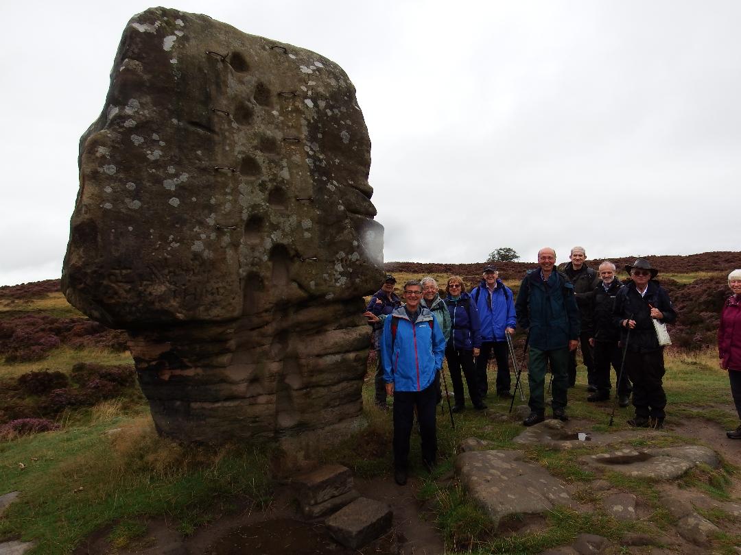
In the market place further along the high street, we saw an innovative gravity fed stone water supply tank built in 1829 following a campaign by the Friendly Society of Women; also the old Co-operative shop, now re-purposed as a youth hostel and Thimble Hall, once recognised in the Guinness Book of Records as the world's smallest detached house.
We then headed back down to the river Bradford via the public conveniences and a couple of old stone bridges, then on up towards Castle Ring (and ancient bronze age fortified hilltop settlement dug in around 7c 5c BC.).
After a coffee stop at a vantage point looking back on our route, we were treated to a beautiful rainbow framing Youlgreave.
The walk continued through Harthill Wood and on to Harthill Moor where we looked at the stone circle known as nine stone close or the grey ladies (even though only 4 stones still remain, they are upright and are the tallest of this type in Derbyshire).
Lunch was taken in warm sunshine at a sheltered, but prominent position near a natural rock feature known as Mock Beggars Hall or Robin Hood's Stride.
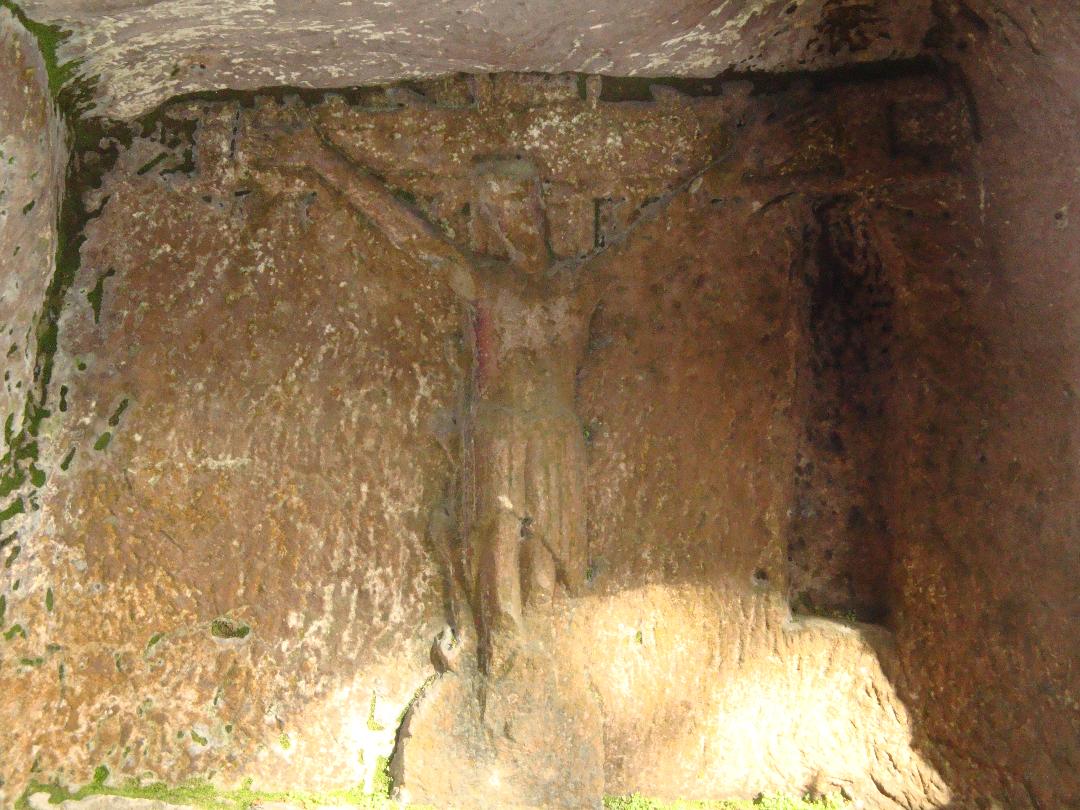
After lunch a short walk through Cratcliff Woods brought us to the 14 th century hermit's cave which features a stone carved sleeping bench and wall sculpture relief of Christ on the cross.
Our return route took us via Cliff Farm and Mawstone Lead Mine (scene of the worst Derbyshire Lead mining disaster in which 8 men were killed by underground explosion in 1932).
The final stretch back to the start was along the old portway road by the banks of the river Bradford and also took in a small old hump back stone bridge and some impressive limestone rock outcrops.
Generally the weather remained fairly dry and sunny, with just very occasional light sprinkles of rain and all agreed that yet again getting out walking in spite of any fears about the forecast had definitely been the right thing to do.
Rick Hedley
Northern Lake District: 5th-28th October
Twenty walking group members enjoyed this 3 night stay at Derwent Bank, a large country house on the shores of Derwent Water at Portinscale near Keswick, Cumbria. Our visit is summarised as follows.
Friday 25th October: Derwent Water and Cat Bells. 4.3 miles
The group met at Derwent Bank at midday after a dry cloudy morning travelling. David Burke led a circular walk, initially along an excellent path which runs right around the wooded shores of Derwent Water, later ascending to the surrounding lower fells of Cat Bells which provided panoramic views of the lake and surrounding fells. Unfortunately, at the start of the walk the weather started to break, light rain became progressively more serious throughout the walk, by the time we got back to the house we were soaked! Fortunately our spirits were raised by afternoon tea and cake, after checking in.
Saturday and Sunday walks were led by HF Holiday walk leaders :-
Saturday 26th October. Glenderaterra and Latrigg 9.5 miles.
The rain had gone and conditions improved as the day progressed. The walk in a nutshell: From Threlkeld, ascend the lonely valley of Glenderaterra Beck before turning south to the stunning viewpoint on top of Lattrigg. This is a knockout walk for views across Derwent Water from the slopes of Lonscale Fell.
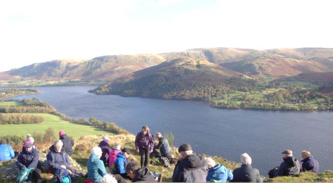
Sunday 27th October. Pooley Bridge to Aira Force 7 miles
A bright day with sunny intervals. The walk started from Pooley Bridge and joined the Ullswater Way south along the panoramic balcony path beneath Gowbarrow Fell eventually arriving at the spectacular Aira Force waterfall. We then took a cruise on Ullswater to Glenridding from where our coach transport picked us up.
Monday 28th October.
Check out day. We all did our own thing. It was a beautifully sunny day, a cloudless blue sky, crystal clear visas highlighting the magnificent autumn colours (payback for Friday afternoon).
U3A Walk Wednesday 30th October 2019
Walk report 30 th October 2019. Castleton and Hope valley. ( Merlyn & Joyce ) We were fortunate that the recent wet weather had passed and a bright sunny cool autumn day attracted 25 walkers. This 5 mile flat walk was a chance to admire the beauty of the Dark Peak and surrounding hills without climbing them!
The group met at High Lane and shared cars for the drive to Castleton where we parked below Winnats Pass. Starting from the visitors centre we followed the River Peakshole as it weaved its way through the small streets passing two small water powered mills now converted to houses. Peakshole river exits from Peak cave and the walk would later follow this river again on our return.
We turned off the quiet country lane at the training and conference outdoor centre heading on field paths towards Hope. Along the route we watched a group of young children from the outdoor centre on a high zip wire and then passed Losehill Hall which is now a hotel, spa and YHA. Coffee stop was taken just passed Spring House farm on a raised section of field overlooking farm land and distant views of surrounding hills. Good field paths led us to the footbridge over the Hope Cement works railway line and then to Killhill Bridge for a group photo. We joined a path alongside the River Noe passing the old Hope mill and ruined water wheel before reaching the main road into Hope.
Returning our route passed behind Hope's St Peters 14 th century church and a very short incline mostly flat led to field paths back to Castleton. The paths followed the River Peakshole again on the opposite side of the valley. Lunch was taken near an oxbow of the river under autumn clad tree canopy.
Merlyn gave some history of the area , Pindale lead mine and the 90 year celebration of Hope Valley Cement works.
Despite the past days heavy rain most paths were firm and good except for two wall stiles with deep mud and ponds which gave us a challenge. All enjoyed the walk and thanked the leaders.
Merlyn & Joyce Young
Wednesday 27 TH NOV 2019 Bollington Area
The walk for 27 th Nov. was extremely well supported with 25 walkers in spite of the rainy forecast. Conditions under foot were not good with all the rain we have had over the last few weeks. This together with the closure of a section of canal towpath necessitated a slightly modified route to avoid the worst of the mud and the closed section of towpath, so the route by and large used established tracks and quiet lanes starting from Bollington carpark next to the cricket ground.
The first stretch consisted of a section of The Middlewood Way as far as Brookledge Lane Bridge, referred to on older maps as Dangerous Corner'. Apparently so the story goes this was where the overhead cable cages carrying stone from Styperson Quarry to Stypeson Saw Mill had to make a 90 degree turn, resulting in some of the stone falling out of the cage with potentially nasty consequences. After walking a short section of canal towpath plus a few yards on Sugar Lane, we entered Styperson Park, also known as Adlington Quarries and Mines where coal mining and quarrying began about the middle of the 18 th century. When the Macclesfield canal opened in 1831 it enabled both stone and coal to be transported more easily. Styperson Blue stone, an excellent paving material, was mainly destined for London. A minor detour led us to the remains of foundations of the cable system towers at the head of Styperson Pool where we took our coffee stop.
After a short uphill section through the woods we came out onto Long Lane where on a good day there are splendid views from here over to Alderley Edge and beyond. From here our original planned route involved a steep downhill section through the fields, but the rain had made this option too wet and slippery. Instead we returned to the carpark via Long Lane. Once back in Bollington 20 walkers enjoyed a very satisfying lunch in The Vale Inn.
Sam & Irene
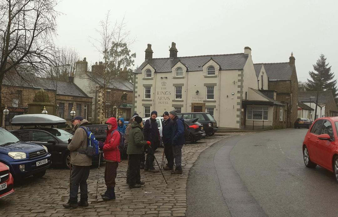
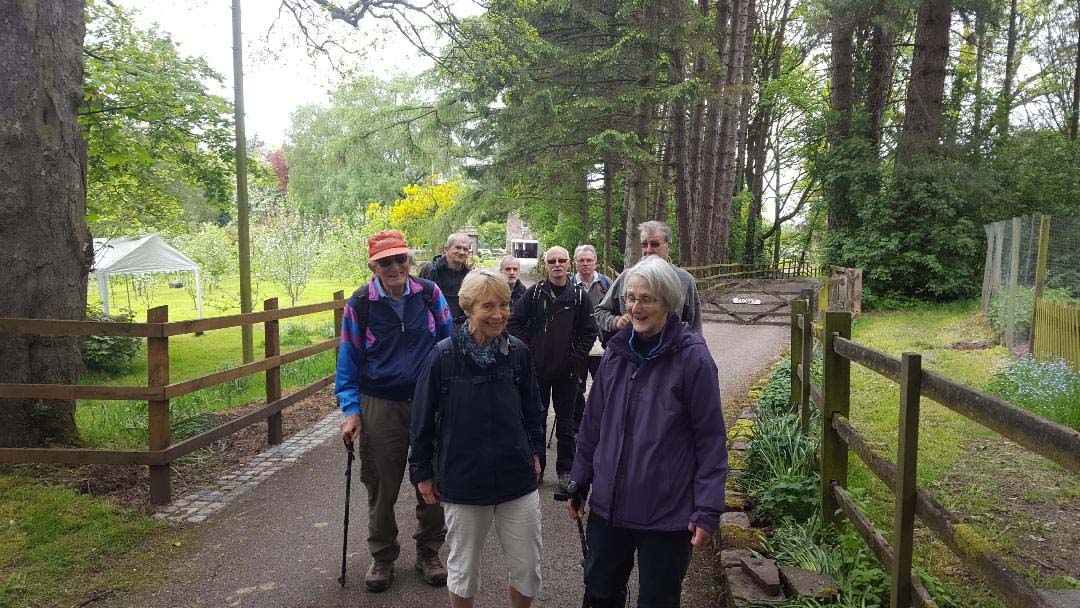
Christmas Walk Wednesday 18th December 2019. Chapel-en-le-Frith Area. 4.3 miles
|


.JPG)